Approximate Location Map
Large Map »
Latitude: 50.7305 / 50°43'49"N
Longitude: -1.164 / 1°9'50"W
OS Eastings: 459100
OS Northings: 92658
OS Grid: SZ591926
Mapcode National: GBR 9CN.0K3
Mapcode Global: FRA 87G4.SF9
Plus Code: 9C2WPRJP+6C
Entry Name: 6, St James's Street
Listing Date: 18 May 1972
Grade: II
Source: Historic England
Source ID: 1222233
English Heritage Legacy ID: 414356
ID on this website: 101222233
Location: Ryde, Isle of Wight, PO33
County: Isle of Wight
Civil Parish: Ryde
Built-Up Area: Ryde
Traditional County: Hampshire
Lieutenancy Area (Ceremonial County): Isle of Wight
Church of England Parish: Ryde
Church of England Diocese: Portsmouth
Tagged with: Building
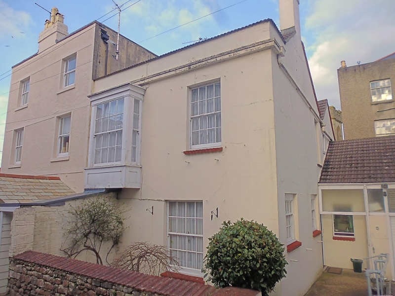
ST JAMES'S STREET
1.
1577
No 6
SZ 5992 3/291
II GV
2.
Circa 1800 an early and substantial house for Ryde. Entrance front facing
North. Three storeys stucco faced. The walls raised with brick coping
to conical eaves of low pitch hipped slate roof. Three windows, recessed,
sash, glazing bars intact, block sills. Superimposed bay windows of
three lights to ground and first floor West. Sashes, glazing bars intact
ground floor, incised dividing pilaster strips, plain frieze, shallow project-
ing cornice, flaired to side, incised panels to first floor apron. Fine
Tuscan porch with free standing columns to front pilasters to wall, entabla-
ture over, now glazed in. Recessed door of six incised panels in architrave
surround.
Elevation to street is rough cast with rendered bands and surround. Two
windows, recessed, sash, later glazing bars, rendered surrounds, block
sills. Single storey stucco faced wing to West, with parapet and block
string course. Round headed withe containing a small casement window,
hatch to left.
The interior contains a good but simple, central staircase. Continuous
mahogany handrail, plain square balusters, scrolled round at foot. The
tread mouldings project with shaped brackets applied to side. The
flight rise round a narrow rectangular well, curved at each end.
Forms a group with No 5 St Thomas's Street.
Listing NGR: SZ5910492661
External links are from the relevant listing authority and, where applicable, Wikidata. Wikidata IDs may be related buildings as well as this specific building. If you want to add or update a link, you will need to do so by editing the Wikidata entry.


Other nearby listed buildings
