Approximate Location Map
Large Map »
Latitude: 52.344 / 52°20'38"N
Longitude: 1.5018 / 1°30'6"E
OS Eastings: 638620
OS Northings: 277547
OS Grid: TM386775
Mapcode National: GBR XNV.2HG
Mapcode Global: VHM72.ZB9X
Plus Code: 9F438GV2+JP
Entry Name: 59, Thoroughfare
Listing Date: 18 July 1972
Grade: II
Source: Historic England
Source ID: 1224541
English Heritage Legacy ID: 420638
ID on this website: 101224541
Location: Halesworth, East Suffolk, IP19
County: Suffolk
District: East Suffolk
Civil Parish: Halesworth
Built-Up Area: Halesworth
Traditional County: Suffolk
Lieutenancy Area (Ceremonial County): Suffolk
Church of England Parish: Halesworth St Mary
Church of England Diocese: St.Edmundsbury and Ipswich
Tagged with: Building
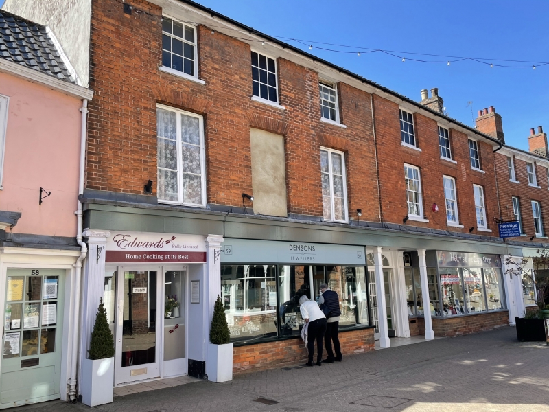
1. THOROUGHFARE
1163 (West Side)
No 59
TM 3877 1/91
II GV
2.
Early C19, 3 storey, red brick, pantiles. Modern shop front, with 3 fluted
Ionic pilasters, flanking side entrance and shop front. 2 sash windows at
1st floor and 4 painted panels at 2nd floor. 2 French casements 1st floor
left and blank panel.
Nos 56 to 59 (consec) form a group.
Listing NGR: TM3860777547
External links are from the relevant listing authority and, where applicable, Wikidata. Wikidata IDs may be related buildings as well as this specific building. If you want to add or update a link, you will need to do so by editing the Wikidata entry.


Other nearby listed buildings
