Approximate Location Map
Large Map »
Latitude: 50.7317 / 50°43'54"N
Longitude: -2.7583 / 2°45'29"W
OS Eastings: 346579
OS Northings: 92725
OS Grid: SY465927
Mapcode National: GBR PP.0K01
Mapcode Global: FRA 5734.P7L
Plus Code: 9C2VP6JR+MM
Entry Name: 58, South Street
Listing Date: 19 September 1975
Grade: II
Source: Historic England
Source ID: 1228327
English Heritage Legacy ID: 402922
ID on this website: 101228327
Location: New Zealand, Dorset, DT6
County: Dorset
Civil Parish: Bridport
Built-Up Area: Bridport
Traditional County: Dorset
Lieutenancy Area (Ceremonial County): Dorset
Church of England Parish: Bridport St Mary
Church of England Diocese: Salisbury
Tagged with: Building
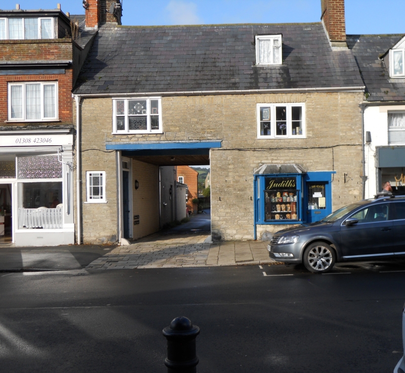
1.
5191 SOUTH STREET
(West Side)
No 58
SY 4692 1/100
II
2.
C18. Hammer dressed stone. Pitched slate roof. 2 storeys and attics. 1
casement and 1 tripartite sash on 1st floor. Cl9 canted bay shop front and
½ glazed door. Wide entry to coal yard. 1 attic dormer.
Listing NGR: SY4658092726
External links are from the relevant listing authority and, where applicable, Wikidata. Wikidata IDs may be related buildings as well as this specific building. If you want to add or update a link, you will need to do so by editing the Wikidata entry.


Other nearby listed buildings
