Approximate Location Map
Large Map »
Latitude: 50.7338 / 50°44'1"N
Longitude: -2.7587 / 2°45'31"W
OS Eastings: 346549
OS Northings: 92966
OS Grid: SY465929
Mapcode National: GBR PP.0BWQ
Mapcode Global: FRA 5734.P14
Plus Code: 9C2VP6MR+GG
Entry Name: 11, West Street
Listing Date: 19 September 1975
Grade: II
Source: Historic England
Source ID: 1229153
English Heritage Legacy ID: 403947
ID on this website: 101229153
Location: Bridport, Dorset, DT6
County: Dorset
Civil Parish: Bridport
Built-Up Area: Bridport
Traditional County: Dorset
Lieutenancy Area (Ceremonial County): Dorset
Church of England Parish: Bridport St Mary
Church of England Diocese: Salisbury
Tagged with: Building
1.
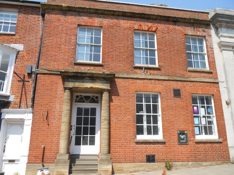
5l91 WEST STREET
(North Side)
No 11
SY 4692 1/176
II GV
2.
C18. Red brick. Stone plinth, string and cornice. 2 storeys. Parapet. 2 ranges
of sashes. Stone doorway with engaged Doric columns supporting entablature. Door
with fanlight.
Nos 7 to 25 (odd) form a group.
Listing NGR: SY4655192969
External links are from the relevant listing authority and, where applicable, Wikidata. Wikidata IDs may be related buildings as well as this specific building. If you want to add or update a link, you will need to do so by editing the Wikidata entry.


Other nearby listed buildings
