Approximate Location Map
Large Map »
Latitude: 51.46 / 51°27'35"N
Longitude: -2.4784 / 2°28'42"W
OS Eastings: 366860
OS Northings: 173554
OS Grid: ST668735
Mapcode National: GBR JW.M993
Mapcode Global: VH88Q.0K4M
Plus Code: 9C3VFG5C+XJ
Entry Name: The Laurels
Listing Date: 11 May 1953
Grade: II
Source: Historic England
Source ID: 1231447
English Heritage Legacy ID: 406594
ID on this website: 101231447
Location: Warmley, South Gloucestershire, BS15
County: South Gloucestershire
Civil Parish: Siston
Built-Up Area: Bristol
Traditional County: Gloucestershire
Lieutenancy Area (Ceremonial County): Gloucestershire
Church of England Parish: Warmley
Church of England Diocese: Bristol
Tagged with: Architectural structure
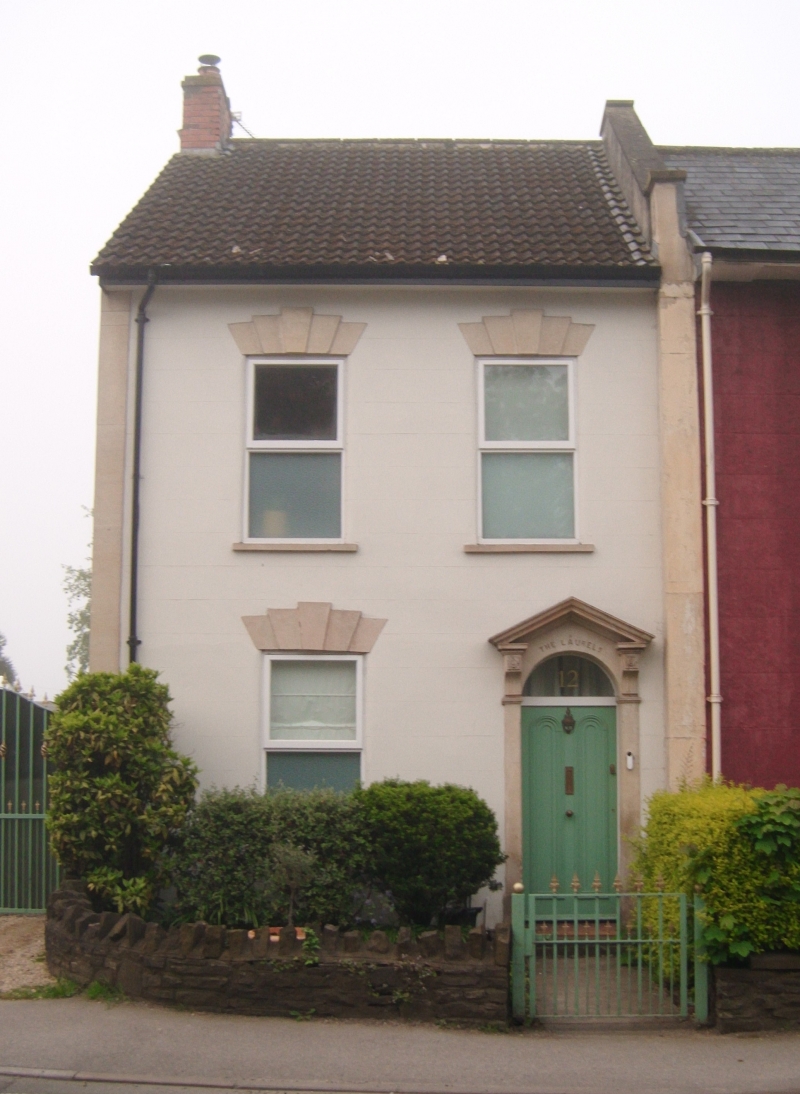
1.
5118 SISTON HIGH STREET
Warmley
No 12
(The Laurels)
ST 6673 11/222 11.5.53
II GV
2.
Left hand wing of a small early C19 terrace abutting Apex House (qv).
Altered. Rendered with slate roof. Two storeys, 3 windows, modern casements.
Arched doorway with open pediment and plain fanlight over door. End pilaster
to left. Included for group value.
Listing NGR: ST6686073554
External links are from the relevant listing authority and, where applicable, Wikidata. Wikidata IDs may be related buildings as well as this specific building. If you want to add or update a link, you will need to do so by editing the Wikidata entry.


Other nearby listed buildings
