Approximate Location Map
Large Map »
Latitude: 50.8184 / 50°49'6"N
Longitude: -1.1484 / 1°8'54"W
OS Eastings: 460089
OS Northings: 102442
OS Grid: SU600024
Mapcode National: GBR 9BH.QGD
Mapcode Global: FRA 86HX.SJH
Plus Code: 9C2WRV92+9M
Entry Name: Boundary Marker 154 Metres North of No 43 Gunners Way
Listing Date: 20 April 1983
Grade: II
Source: Historic England
Source ID: 1233815
English Heritage Legacy ID: 409390
ID on this website: 101233815
Location: Elson, Gosport, Hampshire, PO12
County: Hampshire
District: Gosport
Electoral Ward/Division: Elson
Parish: Non Civil Parish
Built-Up Area: Gosport
Traditional County: Hampshire
Lieutenancy Area (Ceremonial County): Hampshire
Church of England Parish: Elson St Thomas
Church of England Diocese: Portsmouth
Tagged with: Boundary marker
MILITARY ROAD
1.
5232
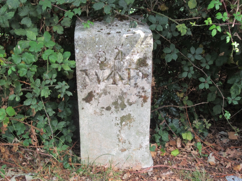
Boundary marker
SU 60 SW 2/76 154 metres north of
No 43 Gunners Way
II
2.
Mid C19. Cast iron square post with raised markings, comprising an arrow above the
letters WD, above the date 1857. A typical example of a series of depot boundary marks.
Listing NGR: SU5940401178
External links are from the relevant listing authority and, where applicable, Wikidata. Wikidata IDs may be related buildings as well as this specific building. If you want to add or update a link, you will need to do so by editing the Wikidata entry.


Other nearby listed buildings
