Approximate Location Map
Large Map »
Latitude: 51.045 / 51°2'42"N
Longitude: 0.415 / 0°24'54"E
OS Eastings: 569388
OS Northings: 130074
OS Grid: TQ693300
Mapcode National: GBR NSG.HR4
Mapcode Global: FRA C6RC.3JB
Plus Code: 9F322CW8+22
Entry Name: 4 and 5, Upper Platt
Listing Date: 13 May 1987
Grade: II
Source: Historic England
Source ID: 1237671
English Heritage Legacy ID: 414924
ID on this website: 101237671
Location: Ticehurst, Rother, East Sussex, TN5
County: East Sussex
District: Rother
Civil Parish: Ticehurst
Built-Up Area: Ticehurst
Traditional County: Sussex
Lieutenancy Area (Ceremonial County): East Sussex
Church of England Parish: Ticehurst St Mary
Church of England Diocese: Chichester
Tagged with: Building
TQ 6830-6930
34/45
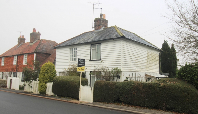
TICEHURST
UPPER PLATT
Nos 4 and 5
GV
II
One building. Early C19. Two storeys. Two windows. Ground floor painted
brick, above weather-boarded. Hipped slate roof. The west house has a small
original porch.
Listing NGR: TQ6938830074
External links are from the relevant listing authority and, where applicable, Wikidata. Wikidata IDs may be related buildings as well as this specific building. If you want to add or update a link, you will need to do so by editing the Wikidata entry.


Other nearby listed buildings
