Approximate Location Map
Large Map »
Latitude: 52.8193 / 52°49'9"N
Longitude: -2.0334 / 2°2'0"W
OS Eastings: 397845
OS Northings: 324644
OS Grid: SJ978246
Mapcode National: GBR 285.8Q5
Mapcode Global: WHBDV.QDXH
Plus Code: 9C4VRX98+PJ
Entry Name: Stables at Ingestre Hall to East of Old Stables
Listing Date: 17 March 1953
Grade: II
Source: Historic England
Source ID: 1242895
English Heritage Legacy ID: 443942
ID on this website: 101242895
Location: Ingestre, Stafford, Staffordshire, ST18
County: Staffordshire
District: Stafford
Civil Parish: Ingestre
Traditional County: Staffordshire
Lieutenancy Area (Ceremonial County): Staffordshire
Church of England Parish: Ingestre St Mary the Virgin
Church of England Diocese: Lichfield
Tagged with: Stable
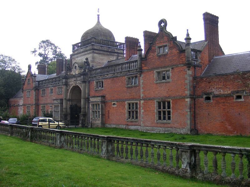
INGESTRE
1.
2385
Stables at Ingestre Hall
SJ 92 SE 19/6A to East of Old Stables
17.3.53.
II
2.
Mainly C19. Built round a court. Brick with stone dressings and slate roofs.
Entrance tower on North with domed top. Porte cochere in South range. 2
storeys. Stone mullioned windows.
Listing NGR: SJ9784524644
External links are from the relevant listing authority and, where applicable, Wikidata. Wikidata IDs may be related buildings as well as this specific building. If you want to add or update a link, you will need to do so by editing the Wikidata entry.


Other nearby listed buildings
