Approximate Location Map
Large Map »
Latitude: 51.4234 / 51°25'24"N
Longitude: -1.7261 / 1°43'34"W
OS Eastings: 419139
OS Northings: 169409
OS Grid: SU191694
Mapcode National: GBR 4X2.NFV
Mapcode Global: VHC1P.1HB6
Plus Code: 9C3WC7FF+8H
Entry Name: 21, Saint Martins
Listing Date: 21 October 1974
Grade: II
Source: Historic England
Source ID: 1243237
English Heritage Legacy ID: 446886
ID on this website: 101243237
Location: Marlborough, Wiltshire, SN8
County: Wiltshire
Civil Parish: Marlborough
Built-Up Area: Marlborough
Traditional County: Wiltshire
Lieutenancy Area (Ceremonial County): Wiltshire
Tagged with: Building
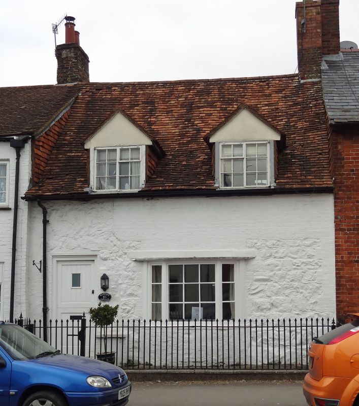
SAINT MARTINS
1.
5407
(North Side)
No 21
SU 1969 1/300
II GV
2.
Probably Cl8. Colourwashed hammer-dressed rubblestone, with colourwashed brick
dressings. Pitched tile roof. Brick stack. 1 storeys and attics. 2 attic
dormers, tile-hung cheeks, with modern casements. 1 canted bay, with glazing
bars.
Nos 6 to 28 (consec) form a group.
Listing NGR: SU1913969409
External links are from the relevant listing authority and, where applicable, Wikidata. Wikidata IDs may be related buildings as well as this specific building. If you want to add or update a link, you will need to do so by editing the Wikidata entry.


Other nearby listed buildings
