Approximate Location Map
Large Map »
Latitude: 52.2476 / 52°14'51"N
Longitude: 0.7117 / 0°42'42"E
OS Eastings: 585214
OS Northings: 264513
OS Grid: TL852645
Mapcode National: GBR QF0.0RC
Mapcode Global: VHKD4.9R3V
Plus Code: 9F426PX6+2M
Entry Name: 10, 11 and 12, St Johns Street
Listing Date: 12 July 1972
Grade: II
Source: Historic England
Source ID: 1244961
English Heritage Legacy ID: 467186
ID on this website: 101244961
Location: Bury St Edmunds, West Suffolk, IP33
County: Suffolk
District: West Suffolk
Civil Parish: Bury St Edmunds
Built-Up Area: Bury St Edmunds
Traditional County: Suffolk
Lieutenancy Area (Ceremonial County): Suffolk
Church of England Parish: Bury St Edmunds St John the Evangelist
Church of England Diocese: St.Edmundsbury and Ipswich
Tagged with: Building
BURY ST EDMUNDS
TL8564NW ST JOHN'S STREET
639-1/3/600 (West side)
12/07/72 Nos.10, 11 AND 12
GV II
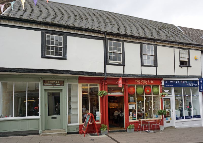
House and shop, now divided into 3 shops. C16 core; C18 and
C19 front with alterations of 1991. Timber-framed and rendered
with panels of mock timbering; jettied along the street
frontage; tiled roof with a wood modillion eaves cornice.
EXTERIOR: 2 storeys and the remains of a cellar. 4 window
range: all sashes in flush cased frames, irregularly spaced,
16-pane to the outer windows, longer and narrower with 12
panes to the 2 inner windows. The joist ends of the jetty are
covered by a moulded wood fascia board. The ground storey has
3 separate late C19 shop windows with vertical glazing bars
and panelled stall boards. 2 shop doors were reinstated in
1991. 2 wings extend at the rear.
INTERIOR: 4 bays to the front range. Many original features
have been removed; little visible on the ground storey. On the
upper storey a section of studding with a blocked original
window along the front wall. Roof inaccessible. The 3-bay C17
rear range on the north has a shallow-pitched roof of c1920.
Listing NGR: TL8521464513
External links are from the relevant listing authority and, where applicable, Wikidata. Wikidata IDs may be related buildings as well as this specific building. If you want to add or update a link, you will need to do so by editing the Wikidata entry.


Other nearby listed buildings
