Approximate Location Map
Large Map »
Latitude: 52.9615 / 52°57'41"N
Longitude: -1.1701 / 1°10'12"W
OS Eastings: 455843
OS Northings: 340785
OS Grid: SK558407
Mapcode National: GBR LJL.RH
Mapcode Global: WHDGS.0T3H
Plus Code: 9C4WXR6H+JX
Entry Name: 238, Alfreton Road
Listing Date: 1 October 1985
Grade: II
Source: Historic England
Source ID: 1246310
English Heritage Legacy ID: 454753
ID on this website: 101246310
Location: Radford, Nottingham, Nottinghamshire, NG7
County: City of Nottingham
Electoral Ward/Division: Arboretum
Parish: Non Civil Parish
Built-Up Area: Nottingham
Traditional County: Nottinghamshire
Lieutenancy Area (Ceremonial County): Nottinghamshire
Church of England Parish: All Souls and Saint Peter, Radford
Church of England Diocese: Southwell and Nottingham
Tagged with: Building
NOTTINGHAM
SK54SE ALFRETON ROAD, Radford
646-1/4/2 (North East side)
01/10/85 No.238
II
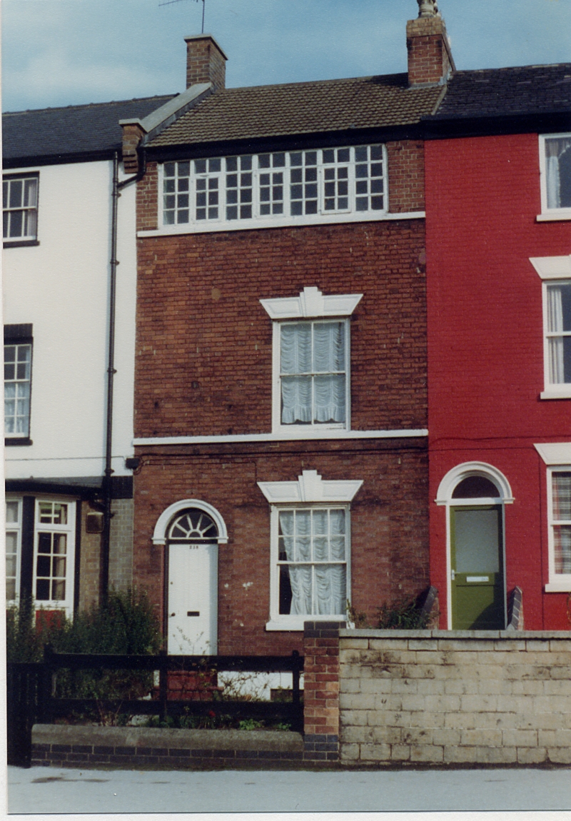
Terraced house with lacemaker's workshop. Early C19, altered
and restored C20. Red brick with stucco dressings and retiled
roof. Rendered basement. First and second floor sill bands. 3
storeys plus basement; single bay. Ground floor has to left a
moulded round-arched doorway with panelled door and fanlight.
To right, a sash, partly reglazed. Above, a similar sash. Both
these windows have reeded wedge lintels with keystones. Above
again, a glazing bar casement, 7-lights, to the workshop.
Similar window at rear.
INTERIOR is said to contain several reeded fireplace surrounds
and exposed beams and joists to workshop.
This building is a rare survival of numerous domestic
workshops built c1780-1840 for the hosiery and lace
industries.
(Transactions of the Thoroton Society of Nottingham: Chapman
SDE: Working class housing in Nottingham during the Industrial
Rev.: Nottingham: 1963-).
Listing NGR: SK5584340785
External links are from the relevant listing authority and, where applicable, Wikidata. Wikidata IDs may be related buildings as well as this specific building. If you want to add or update a link, you will need to do so by editing the Wikidata entry.


Other nearby listed buildings
