Approximate Location Map
Large Map »
Latitude: 51.0072 / 51°0'26"N
Longitude: -2.2007 / 2°12'2"W
OS Eastings: 386014
OS Northings: 123113
OS Grid: ST860231
Mapcode National: GBR 1XH.VTT
Mapcode Global: FRA 668G.4H1
Plus Code: 9C3V2Q4X+VP
Entry Name: Boundary Wall Flanking Tout Hill to South West of Old School House
Listing Date: 15 October 1973
Grade: II
Source: Historic England
Source ID: 1261174
English Heritage Legacy ID: 438228
ID on this website: 101261174
Location: Enmore Green, Dorset, SP7
County: Dorset
Civil Parish: Shaftesbury
Built-Up Area: Shaftesbury
Traditional County: Dorset
Lieutenancy Area (Ceremonial County): Dorset
Church of England Parish: Shaftesbury and Enmore Green St James
Church of England Diocese: Salisbury
Tagged with: Wall
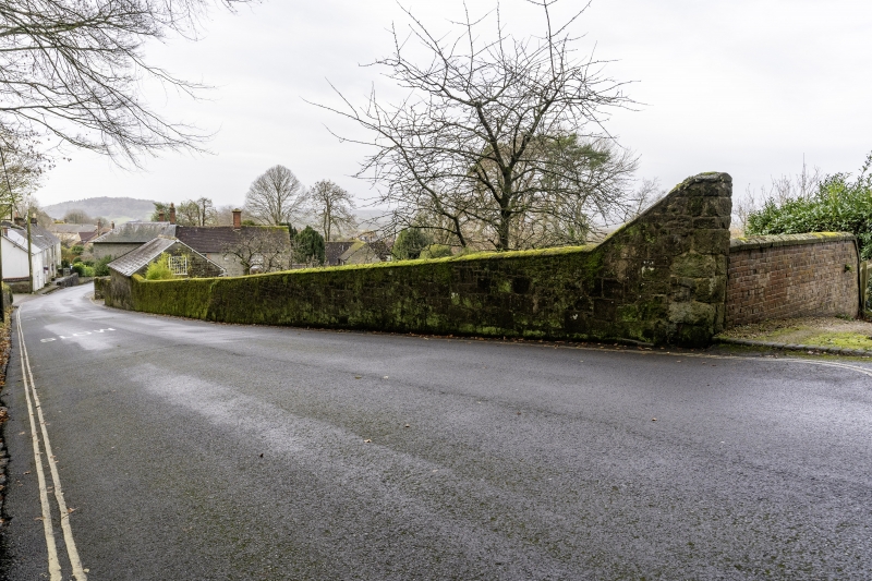
1615 TOUT HILL
Boundary Wall flanking Tout Hill
to south-west of Old School House
ST 8623 1/253A
ST 8523 4/253A II
Wall of stone rubble with coping. Extends as far as outbuilding to south-west of Old School House. Probably contemporary with Old School House.
Listing NGR: ST8601423113
External links are from the relevant listing authority and, where applicable, Wikidata. Wikidata IDs may be related buildings as well as this specific building. If you want to add or update a link, you will need to do so by editing the Wikidata entry.


Other nearby listed buildings
