Approximate Location Map
Large Map »
Latitude: 54.188 / 54°11'16"N
Longitude: -1.5059 / 1°30'21"W
OS Eastings: 432338
OS Northings: 477031
OS Grid: SE323770
Mapcode National: GBR KNX0.RG
Mapcode Global: WHC7G.VZ2R
Plus Code: 9C6W5FQV+6J
Entry Name: K6 Telephone Kiosk
Listing Date: 14 June 1988
Grade: II
Source: Historic England
Source ID: 1263288
English Heritage Legacy ID: 432693
ID on this website: 101263288
Location: Wath, North Yorkshire, HG4
County: North Yorkshire
District: Harrogate
Civil Parish: Wath
Traditional County: Yorkshire
Lieutenancy Area (Ceremonial County): North Yorkshire
Tagged with: K6 telephone box
The following building shall be added:
SE 37 NW WATH MAIN STREET
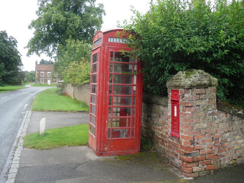
2/88 K6 Telephone Kiosk
GV II
Telephone kiosk. Type K6. Designed 1935 by Sir Giles Gilbert Scott. Made by
various contractors. Cast iron. Square kiosk with domed roof. Unperforated
crowns to top panels and margin glazing to windows and door.
Listing NGR: SE3233877031
External links are from the relevant listing authority and, where applicable, Wikidata. Wikidata IDs may be related buildings as well as this specific building. If you want to add or update a link, you will need to do so by editing the Wikidata entry.


Other nearby listed buildings
