Approximate Location Map
Large Map »
Latitude: 51.4887 / 51°29'19"N
Longitude: -0.1626 / 0°9'45"W
OS Eastings: 527663
OS Northings: 178237
OS Grid: TQ276782
Mapcode National: GBR 7N.NJ
Mapcode Global: VHGQZ.4VC4
Plus Code: 9C3XFRQP+FW
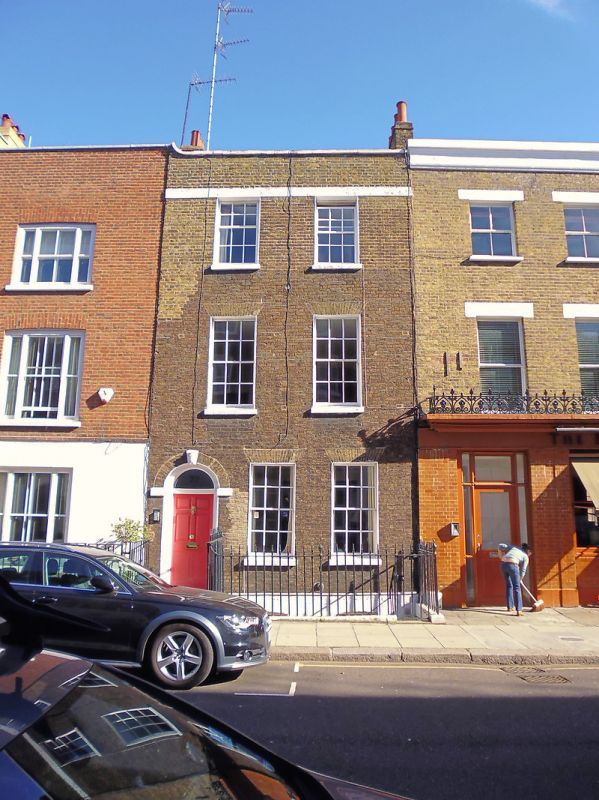
Entry Name: 22, Smith Street SW3
Listing Date: 7 November 1984
Grade: II
Source: Historic England
Source ID: 1265729
English Heritage Legacy ID: 424115
ID on this website: 101265729
Location: Chelsea, Kensington and Chelsea, London, SW3
County: London
District: Kensington and Chelsea
Electoral Ward/Division: Royal Hospital
Parish: Non Civil Parish
Built-Up Area: Kensington and Chelsea
Traditional County: Middlesex
Lieutenancy Area (Ceremonial County): Greater London
Church of England Parish: St Luke and Christ Church Chelsea
Church of England Diocese: London
Tagged with: Building
TQ 2778 SE SMITH STREET SW3
57/9
No 22
GV
II
House. Late C18 three storey plus basement. Two windows. Brown brick. Stucco band
below parapet. Arched, recessed entrance with impost blocks and head decoration to
keystone. Sash windows, glazing bars.
Listing NGR: TQ2766378237
External links are from the relevant listing authority and, where applicable, Wikidata. Wikidata IDs may be related buildings as well as this specific building. If you want to add or update a link, you will need to do so by editing the Wikidata entry.


Other nearby listed buildings
