Approximate Location Map
Large Map »
Latitude: 51.4884 / 51°29'18"N
Longitude: -0.1574 / 0°9'26"W
OS Eastings: 528025
OS Northings: 178213
OS Grid: TQ280782
Mapcode National: GBR 8N.TM
Mapcode Global: VHGQZ.7V4C
Plus Code: 9C3XFRQV+92
Entry Name: Lodge to London Gate, Royal Hospital
Listing Date: 15 April 1969
Grade: II
Source: Historic England
Source ID: 1265917
English Heritage Legacy ID: 423531
ID on this website: 101265917
Location: Chelsea, Kensington and Chelsea, London, SW3
County: London
District: Kensington and Chelsea
Electoral Ward/Division: Royal Hospital
Parish: Non Civil Parish
Built-Up Area: Kensington and Chelsea
Traditional County: Middlesex
Lieutenancy Area (Ceremonial County): Greater London
Church of England Parish: St Luke and Christ Church Chelsea
Church of England Diocese: London
Tagged with: Gatehouse
TQ 2878 SW
58/1
15.4.69
ROYAL HOSPITAL ROAD SW3
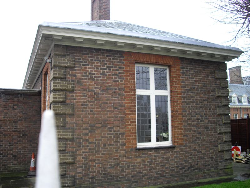
Lodge to London Gate, Royal Hospital
GV
II
Lodge. Circa 1700. Brown brick with red dressings. Single storey. Timber mutule
cornice.
Listing NGR: TQ2802578213
External links are from the relevant listing authority and, where applicable, Wikidata. Wikidata IDs may be related buildings as well as this specific building. If you want to add or update a link, you will need to do so by editing the Wikidata entry.


Other nearby listed buildings
