Approximate Location Map
Large Map »
Latitude: 52.8436 / 52°50'36"N
Longitude: -1.9965 / 1°59'47"W
OS Eastings: 400330
OS Northings: 327344
OS Grid: SK003273
Mapcode National: GBR 27V.L2Y
Mapcode Global: WHBDP.9SJD
Plus Code: 9C4WR2V3+C9
Entry Name: Churchyard Cross
Listing Date: 15 January 1968
Grade: II
Source: Historic England
Source ID: 1273529
English Heritage Legacy ID: 444415
ID on this website: 101273529
Location: St John the Baptist Church, Stowe-by-Chartley, Stafford, Staffordshire, ST18
County: Staffordshire
District: Stafford
Civil Parish: Stowe-by-Chartley
Traditional County: Staffordshire
Lieutenancy Area (Ceremonial County): Staffordshire
Church of England Parish: Stowe-by-Chartley St John the Baptist
Church of England Diocese: Lichfield
Tagged with: Churchyard cross
STOWE-BY-CHARTLEY
l.
2385
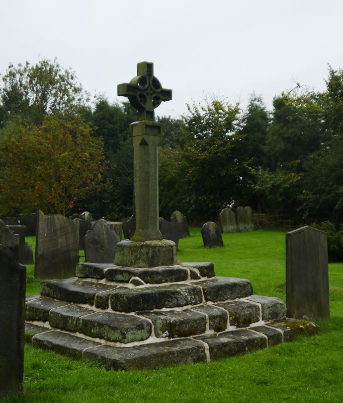
Churchyard Cross
SK 02 NW 1/2 15.1.68.
II
2.
Mediaeval. Octagonal base on 3 steps. The upper part is modern.
Listing NGR: SK0033027344
External links are from the relevant listing authority and, where applicable, Wikidata. Wikidata IDs may be related buildings as well as this specific building. If you want to add or update a link, you will need to do so by editing the Wikidata entry.


Other nearby listed buildings
