Approximate Location Map
Large Map »
Latitude: 52.3678 / 52°22'3"N
Longitude: -2.7184 / 2°43'6"W
OS Eastings: 351181
OS Northings: 274655
OS Grid: SO511746
Mapcode National: GBR BK.RZC9
Mapcode Global: VH843.TRR7
Plus Code: 9C4V979J+4J
Entry Name: 16, King Street
Listing Date: 15 March 1974
Grade: II
Source: Historic England
Source ID: 1281955
English Heritage Legacy ID: 389969
ID on this website: 101281955
Location: Ludlow, Shropshire, SY8
County: Shropshire
Civil Parish: Ludlow
Built-Up Area: Ludlow
Traditional County: Shropshire
Lieutenancy Area (Ceremonial County): Shropshire
Church of England Parish: Ludlow St Laurence
Church of England Diocese: Hereford
Tagged with: Building
LUDLOW
SO5174 KING STREET
825-1/1/337 (South side)
15/03/74 No.16
GV II
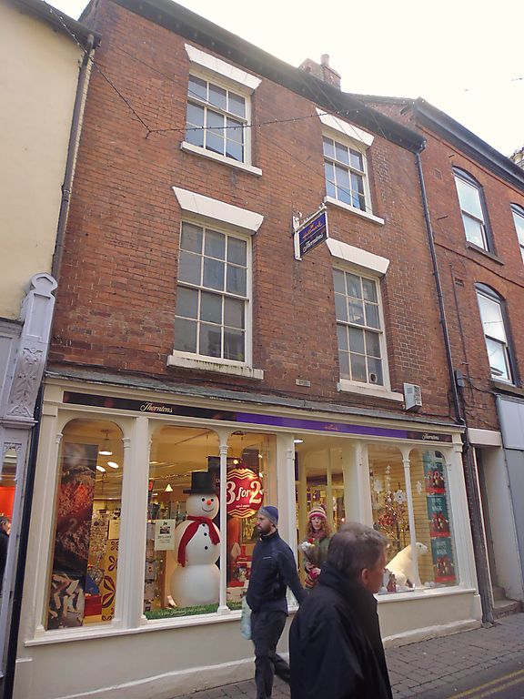
Shop and dwelling. Early C19. Brick; C20 plain tile roof;
brick end stack. 3-storeys; 2-window range. 6/6 sashes under
grooved painted lintels; 3/6 sashes; wood corbelled eaves. C20
shopfront with part-glazed central door and overlight.
Listing NGR: SO5118174655
External links are from the relevant listing authority and, where applicable, Wikidata. Wikidata IDs may be related buildings as well as this specific building. If you want to add or update a link, you will need to do so by editing the Wikidata entry.


Other nearby listed buildings
