Approximate Location Map
Large Map »
Latitude: 51.4913 / 51°29'28"N
Longitude: -2.6165 / 2°36'59"W
OS Eastings: 357296
OS Northings: 177112
OS Grid: ST572771
Mapcode National: GBR C34.87
Mapcode Global: VH88F.LSM3
Plus Code: 9C3VF9RM+GC
Entry Name: Lock Up
Listing Date: 3 June 1976
Grade: II
Source: Historic England
Source ID: 1282059
English Heritage Legacy ID: 380845
ID on this website: 101282059
Location: Westbury on Trym, Bristol, BS9
County: City of Bristol
Electoral Ward/Division: Westbury-on-Trym and Henleaze
Parish: Non Civil Parish
Built-Up Area: Bristol
Traditional County: Gloucestershire
Lieutenancy Area (Ceremonial County): Bristol
Church of England Parish: Westbury-on-Trym
Church of England Diocese: Bristol
Tagged with: Architectural structure
BRISTOL
ST5777 WESTBURY HILL, Westbury On Trym
901-1/26/2091 (East side)
03/06/76 Lock-up
II
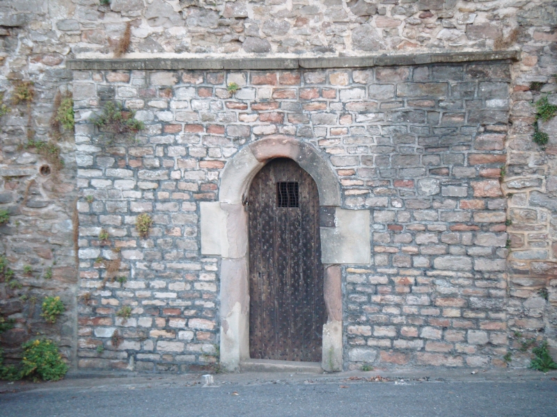
Early C19. Pennant rubble and ashlar. Single cell.
Semicircular-arched doorway and a studded door with small
grilled window. INTERIOR: bench seats to sides of cell.
Listing NGR: ST5729677112
External links are from the relevant listing authority and, where applicable, Wikidata. Wikidata IDs may be related buildings as well as this specific building. If you want to add or update a link, you will need to do so by editing the Wikidata entry.


Other nearby listed buildings
