Approximate Location Map
Large Map »
Latitude: 50.3456 / 50°20'44"N
Longitude: -4.7956 / 4°47'44"W
OS Eastings: 201189
OS Northings: 53255
OS Grid: SX011532
Mapcode National: GBR ZX.99NJ
Mapcode Global: FRA 08V4.1HN
Plus Code: 9C2Q86W3+6P
Entry Name: Menacuddle Baptistery Church
Listing Date: 28 November 1950
Grade: II*
Source: Historic England
Source ID: 1289730
English Heritage Legacy ID: 396373
ID on this website: 101289730
Location: Trethowel, Cornwall, PL25
County: Cornwall
Civil Parish: Treverbyn
Built-Up Area: St Austell
Traditional County: Cornwall
Lieutenancy Area (Ceremonial County): Cornwall
Church of England Parish: St Austell
Church of England Diocese: Truro
Tagged with: Church building
ST AUSTELL
1. BODMIN ROAD
1584A
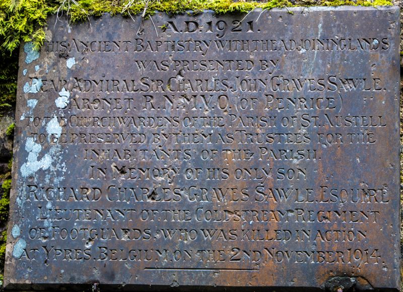
Menacuddle Baptistery
Church
SX 05 SW 9/460 28.11.50.
II*
2.
C15 holy well. Small room approximately 6 ft by 9 ft, with sunken well
trough. 2 Tudor arched doorways. Groined barrel vault of granite. Whole
building of granite including external roof.
Listing NGR: SX0118953255
External links are from the relevant listing authority and, where applicable, Wikidata. Wikidata IDs may be related buildings as well as this specific building. If you want to add or update a link, you will need to do so by editing the Wikidata entry.


Other nearby listed buildings
