Approximate Location Map
Large Map »
Latitude: 51.4622 / 51°27'43"N
Longitude: -2.3187 / 2°19'7"W
OS Eastings: 377956
OS Northings: 173737
OS Grid: ST779737
Mapcode National: GBR 0PL.8M2
Mapcode Global: VH967.RHKY
Plus Code: 9C3VFM6J+VG
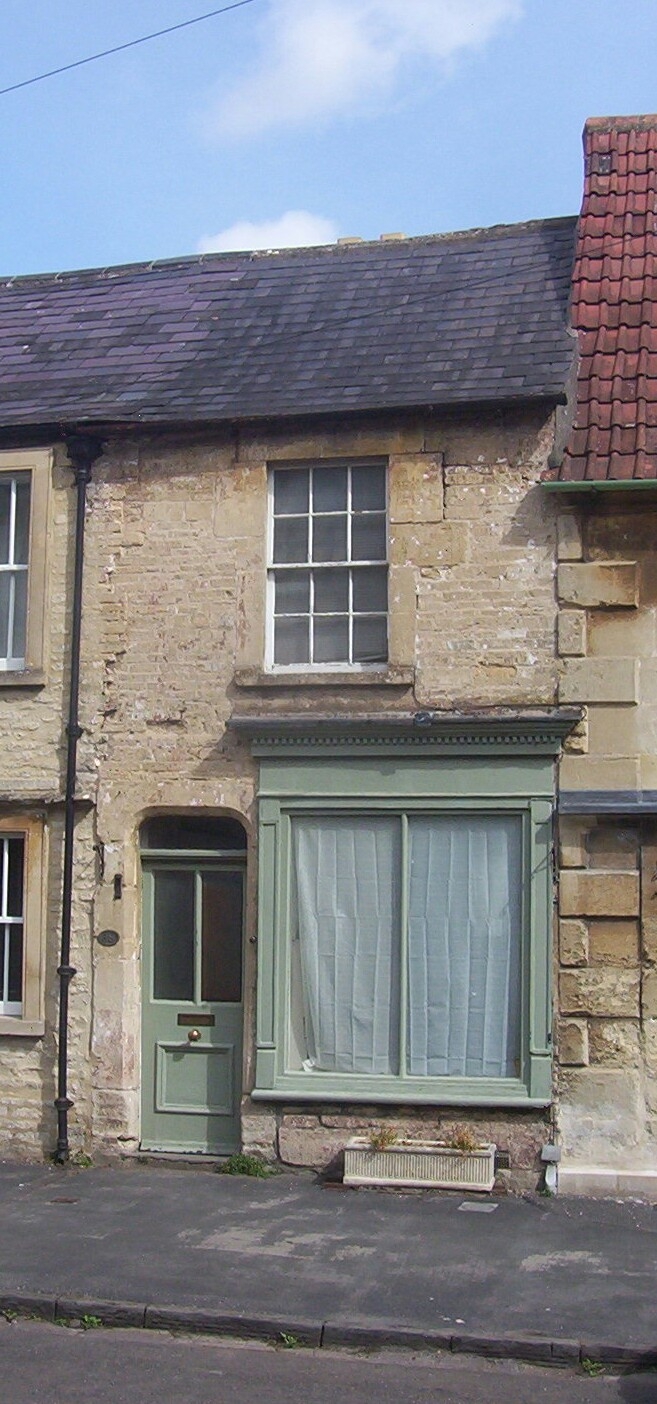
Entry Name: 38, High Street
Listing Date: 10 November 1983
Grade: II
Source: Historic England
Source ID: 1302669
English Heritage Legacy ID: 34493
ID on this website: 101302669
Location: Marshfield, South Gloucestershire, SN14
County: South Gloucestershire
Civil Parish: Marshfield
Built-Up Area: Marshfield
Traditional County: Gloucestershire
Lieutenancy Area (Ceremonial County): Gloucestershire
Church of England Parish: Marshfield
Church of England Diocese: Bristol
Tagged with: Building
ST 7773
13/80
MARSHFIELD C.P.
HIGH STREET (north side)
No. 38
G.V.
II
House, formerly with a shop, in the village street. Early C19. Rubble; slate
roof. 2 storeys. Single shopfront with dentilled cornice on ground floor;
glazing bar sash window on first floor. C20 door under segmental hood to left.
Included for group value.
Listing NGR: ST7795673737
External links are from the relevant listing authority and, where applicable, Wikidata. Wikidata IDs may be related buildings as well as this specific building. If you want to add or update a link, you will need to do so by editing the Wikidata entry.


Other nearby listed buildings
