Approximate Location Map
Large Map »
Latitude: 54.6602 / 54°39'36"N
Longitude: -2.788 / 2°47'16"W
OS Eastings: 349264
OS Northings: 529743
OS Grid: NY492297
Mapcode National: GBR 8GZK.67
Mapcode Global: WH81B.44N7
Plus Code: 9C6VM666+3R
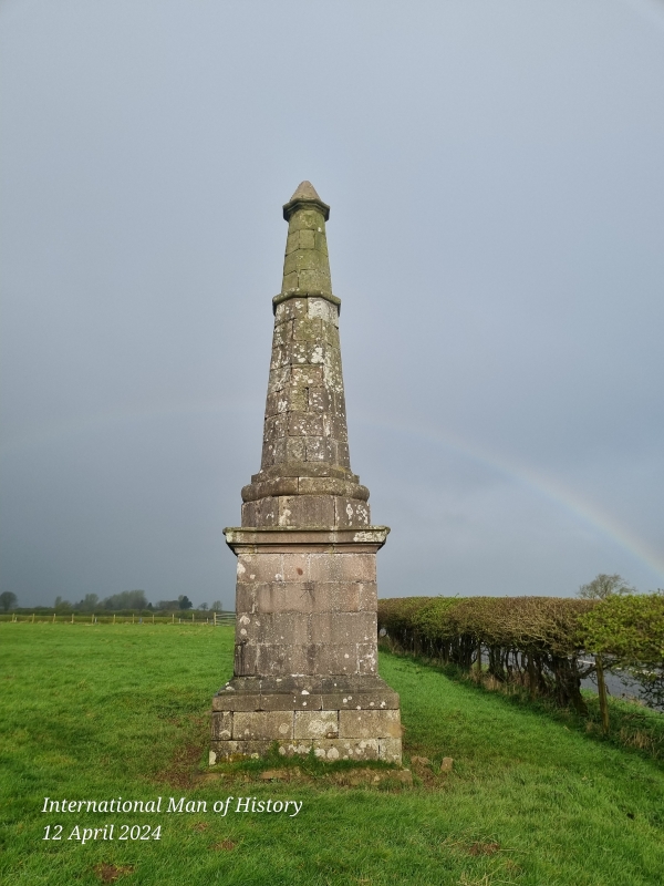
Entry Name: Greystoke Pillar
Listing Date: 27 December 1967
Grade: II
Source: Historic England
Source ID: 1326697
English Heritage Legacy ID: 73787
ID on this website: 101326697
Location: Westmorland and Furness, Cumbria, CA11
County: Cumbria
District: Eden
Civil Parish: Dacre
Traditional County: Cumberland
Lieutenancy Area (Ceremonial County): Cumbria
Church of England Parish: Dacre St Andrew
Church of England Diocese: Carlisle
Tagged with: Architectural structure
MY 42 NE DACRE PENRITH
16/66 Greystoke Pillar
27.12.67
II
Monument. Late C18 for the 11th Duke of Norfolk. Reeded pink sandstone
ashlar. Square base and plinth incorporating an earlier carved coat-of-arms of
the Howard family of Greystoke Castle. Tapering octagonal obelisk on top with a
fillet. O.S. bench mark on one side.
Listing NGR: NY4926429743
External links are from the relevant listing authority and, where applicable, Wikidata. Wikidata IDs may be related buildings as well as this specific building. If you want to add or update a link, you will need to do so by editing the Wikidata entry.


Other nearby listed buildings
