Approximate Location Map
Large Map »
Latitude: 53.3938 / 53°23'37"N
Longitude: -2.5999 / 2°35'59"W
OS Eastings: 360202
OS Northings: 388719
OS Grid: SJ602887
Mapcode National: GBR BY86.X4
Mapcode Global: WH98K.1Y6M
Plus Code: 9C5V9CV2+G2
Entry Name: Wall to Churchyard of Church of St Paul
Listing Date: 4 April 1975
Grade: II
Source: Historic England
Source ID: 1329701
English Heritage Legacy ID: 58740
ID on this website: 101329701
Location: Warrington, Cheshire, WA2
County: Warrington
Electoral Ward/Division: Bewsey and Whitecross
Parish: Non Civil Parish
Built-Up Area: Warrington
Traditional County: Lancashire
Lieutenancy Area (Ceremonial County): Cheshire
Church of England Parish: Warrington Holy Trinity
Church of England Diocese: Liverpool
Tagged with: Wall
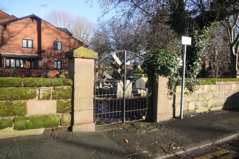
1. BEWSEY ROAD
5150 Wall to Churchyard of
Church of St Paul
SJ 6088 1/20A
IT
2.
Red sandstone wall surrounds churchyard on all 4 sides.
Listing NGR: SJ6020288719
External links are from the relevant listing authority and, where applicable, Wikidata. Wikidata IDs may be related buildings as well as this specific building. If you want to add or update a link, you will need to do so by editing the Wikidata entry.


Other nearby listed buildings
