Approximate Location Map
Large Map »
Latitude: 53.3596 / 53°21'34"N
Longitude: -1.9889 / 1°59'19"W
OS Eastings: 400837
OS Northings: 384742
OS Grid: SK008847
Mapcode National: GBR GYKL.6D
Mapcode Global: WHBB5.FT4C
Plus Code: 9C5W9256+RF
Entry Name: Barn at Beard Hall Farm
Listing Date: 19 September 1977
Grade: II
Source: Historic England
Source ID: 1334775
English Heritage Legacy ID: 81846
ID on this website: 101334775
Location: Low Leighton, High Peak, Derbyshire, SK22
County: Derbyshire
District: High Peak
Civil Parish: New Mills
Traditional County: Derbyshire
Lieutenancy Area (Ceremonial County): Derbyshire
Church of England Parish: New Mills St George
Church of England Diocese: Derby
Tagged with: Barn
NEW MILLS LANESIDE ROAD
1.
5172
(West Side)
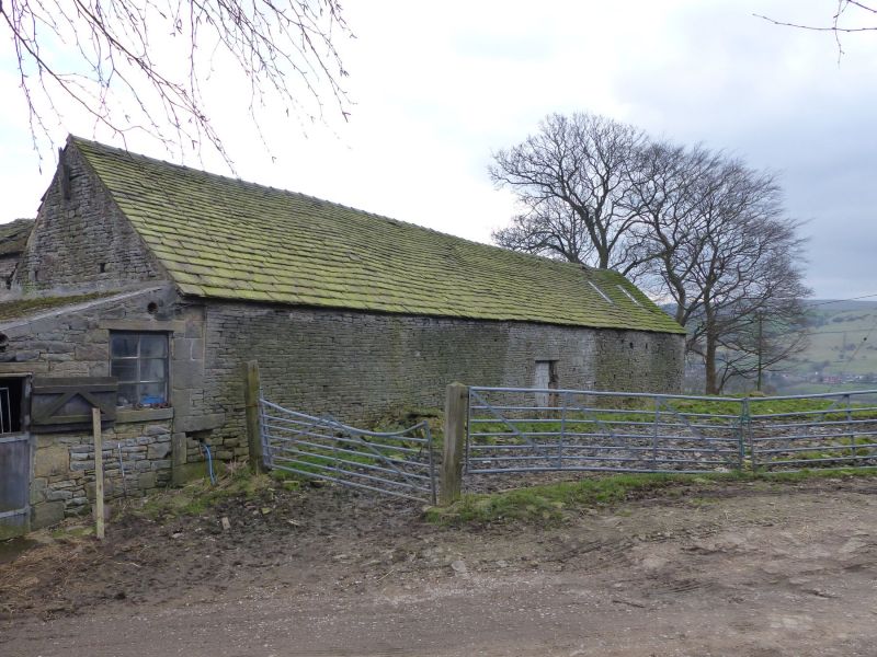
SK 08 SW 3/99A Barn at Beard Hall Farm
II GV
2.
Barn of C17 or early C18 with good kingpost roof. Coursed stone, Welsh slate roof.
Cart entry has carved stone incorporated which may be of early origin.
Listing NGR: SK0083784742
External links are from the relevant listing authority and, where applicable, Wikidata. Wikidata IDs may be related buildings as well as this specific building. If you want to add or update a link, you will need to do so by editing the Wikidata entry.


Other nearby listed buildings
