Approximate Location Map
Large Map »
Latitude: 53.5476 / 53°32'51"N
Longitude: -2.6395 / 2°38'22"W
OS Eastings: 357726
OS Northings: 405849
OS Grid: SD577058
Mapcode National: GBR BW0F.C0
Mapcode Global: WH97Y.F3B6
Plus Code: 9C5VG9X6+26
Entry Name: Railway Bridge
Listing Date: 8 December 1999
Grade: II
Source: Historic England
Source ID: 1384466
English Heritage Legacy ID: 484900
ID on this website: 101384466
Location: Bull Hey, Wigan, Greater Manchester, WN6
County: Wigan
Electoral Ward/Division: Wigan West
Parish: Non Civil Parish
Built-Up Area: Wigan
Traditional County: Lancashire
Lieutenancy Area (Ceremonial County): Greater Manchester
Church of England Parish: Wigan All Saints
Church of England Diocese: Liverpool
Tagged with: Railway bridge
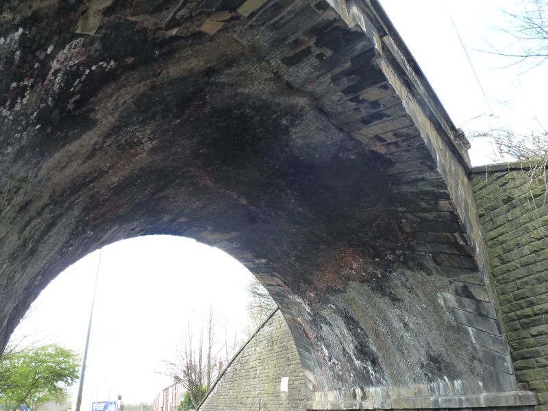
WIGAN
SD50NE FROG LANE
24-1/2/13 Railway bridge
II
Railway bridge over public road. Probably c1838, for the North
Union Railway Company; Sandstone ashlar with rock-faced
abutments. Skew bridge. Large semicircular arch with run-out
rusticated voussoirs, chamfered band, parapets with central
and terminal piers, flat coping.
Listing NGR: SD5772605849
External links are from the relevant listing authority and, where applicable, Wikidata. Wikidata IDs may be related buildings as well as this specific building. If you want to add or update a link, you will need to do so by editing the Wikidata entry.


Other nearby listed buildings
