Approximate Location Map
Large Map »
Latitude: 52.1018 / 52°6'6"N
Longitude: -2.3298 / 2°19'47"W
OS Eastings: 377509
OS Northings: 244883
OS Grid: SO775448
Mapcode National: GBR 0FT.CS4
Mapcode Global: VH934.KFQL
Plus Code: 9C4V4M2C+P3
Entry Name: Milestone
Listing Date: 7 March 2005
Grade: II
Source: Historic England
Source ID: 1391294
English Heritage Legacy ID: 494085
ID on this website: 101391294
Location: Malvern Common, Lower Wyche, Malvern Hills, Worcestershire, WR14
County: Worcestershire
District: Malvern Hills
Civil Parish: Malvern Wells
Built-Up Area: Great Malvern
Traditional County: Worcestershire
Lieutenancy Area (Ceremonial County): Worcestershire
Church of England Parish: Great Malvern
Church of England Diocese: Worcester
Tagged with: Milestone
MALVERN
943/0/10043 A449 WELLS ROAD
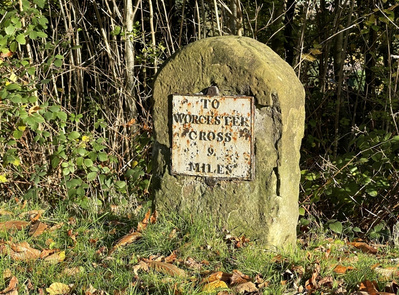
Milestone
GV II
Milestone. Sandstone with rectangular plan and rounded top, carrying a cast iron plate that reads 'TO WORCESTER CROSS 9 MILES'. Forms part of a series along the A449.
External links are from the relevant listing authority and, where applicable, Wikidata. Wikidata IDs may be related buildings as well as this specific building. If you want to add or update a link, you will need to do so by editing the Wikidata entry.


Other nearby listed buildings
