Approximate Location Map
Large Map »
Latitude: 56.0781 / 56°4'41"N
Longitude: -5.452 / 5°27'7"W
OS Eastings: 185283
OS Northings: 692621
OS Grid: NR852926
Mapcode National: GBR DDXN.9GP
Mapcode Global: WH0J4.7H2B
Plus Code: 9C8P3GHX+66
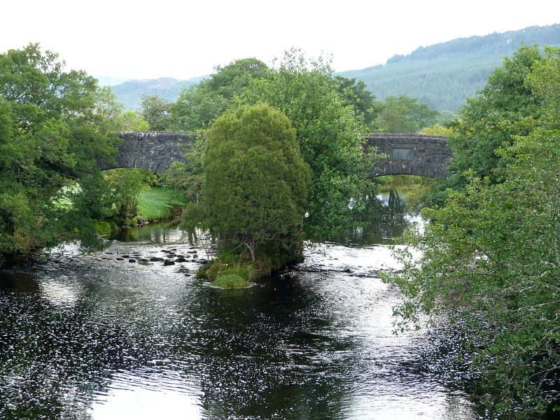
Entry Name: Kilmichael Bridge
Listing Name: Kilmichael Bridge, River Add, Bridgend, Kilmichael Village
Listing Date: 20 July 1971
Category: B
Source: Historic Scotland
Source ID: 343592
Historic Scotland Designation Reference: LB11036
Building Class: Cultural
ID on this website: 200343592
Location: Glassary
County: Argyll and Bute
Electoral Ward: Mid Argyll
Parish: Glassary
Traditional County: Argyllshire
Tagged with: Road bridge
Dated 1737. Quite long; narrow. Four segmental spans. (central pair higher). Rubble; rough-hewn cope to parapet wall. 2 buttresses on each side. Plaque on W. side inscribed "Built by the Shire 1737".
In use on main road between Kilmichael and Lochgilphead.
External links are from the relevant listing authority and, where applicable, Wikidata. Wikidata IDs may be related buildings as well as this specific building. If you want to add or update a link, you will need to do so by editing the Wikidata entry.


Other nearby listed buildings
