Approximate Location Map
Large Map »
Latitude: 56.6444 / 56°38'39"N
Longitude: -2.8885 / 2°53'18"W
OS Eastings: 345611
OS Northings: 750639
OS Grid: NO456506
Mapcode National: GBR VM.4K1D
Mapcode Global: WH7QL.L8R5
Plus Code: 9C8VJ4V6+QJ
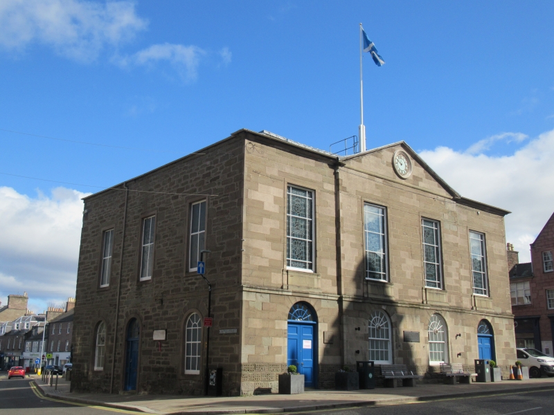
Entry Name: Town And County Hall, Cross, High Street, Forfar
Listing Name: Forfar Town and County Hall, Cross
Listing Date: 11 June 1971
Category: B
Source: Historic Scotland
Source ID: 372761
Historic Scotland Designation Reference: LB31496
Building Class: Cultural
ID on this website: 200372761
Location: Forfar
County: Angus
Town: Forfar
Electoral Ward: Forfar and District
Traditional County: Angus
Tagged with: Architectural structure
James Playfair 1785-8. 2-storey 4-window ashlar front to
Cross, centre 2 pedimented; ground floor openings arched,
square-headed above, formerly architraved with cornice;
remainder rubble, 4 segmental arches in N. wall originally
for weigh-house and butter market. Piend roof, platformed.
Internal alterations 1847, William Scott. Clock 1804;
bellcote demolished 1879.
External links are from the relevant listing authority and, where applicable, Wikidata. Wikidata IDs may be related buildings as well as this specific building. If you want to add or update a link, you will need to do so by editing the Wikidata entry.


Other nearby listed buildings
