Approximate Location Map
Large Map »
Latitude: 51.8116 / 51°48'41"N
Longitude: -2.7147 / 2°42'53"W
OS Eastings: 350822
OS Northings: 212797
OS Grid: SO508127
Mapcode National: GBR FL.X16W
Mapcode Global: VH86T.WQPK
Plus Code: 9C3VR76P+M4
Entry Name: Gates and Railings of No. 6
Listing Date: 15 August 1974
Last Amended: 10 August 2005
Grade: II
Source: Cadw
Source ID: 2244
Building Class: Domestic
ID on this website: 300002244
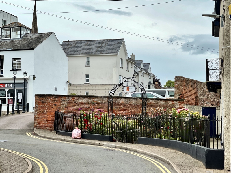
Probably early C19 and contemporary with architectural changes to the house.
A fine set of wrought iron railings with arrow-head tops and cast iron urns on the main stanchions. Dwarf stone wall under railings, double gates with lamp overthrow and lamp bracket intact.
Included for its special interest as well preserved gates and railings which group with the house at No. 6.
External links are from the relevant listing authority and, where applicable, Wikidata. Wikidata IDs may be related buildings as well as this specific building. If you want to add or update a link, you will need to do so by editing the Wikidata entry.


Other nearby listed buildings
