Approximate Location Map
Large Map »
Latitude: 52.9181 / 52°55'5"N
Longitude: -4.1812 / 4°10'52"W
OS Eastings: 253444
OS Northings: 337858
OS Grid: SH534378
Mapcode National: GBR 5M.NBS5
Mapcode Global: WH55K.RX49
Plus Code: 9C4QWR99+6G
Entry Name: Church of St Michael and All Angels
Listing Date: 1 April 1974
Last Amended: 26 September 2005
Grade: II
Source: Cadw
Source ID: 4403
Building Class: Religious, Ritual and Funerary
ID on this website: 300004403
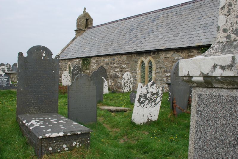
Location: An isolated church on high ground overlooking Morfa Bychan and Black Rock Sands, approximately 3km W of Porthmadog.
County: Gwynedd
Community: Porthmadog
Community: Porthmadog
Locality: Treflys
Traditional County: Caernarfonshire
Tagged with: Church building
A medieval church, probably mainly of the C14, substantially rebuilt and restored in 1888-9. At this time a new chancel was built, new windows were introduced into the nave, and the nave was re-roofed.
A single-chamber parish church with detail in simple C19 Gothic style, of rubble stone with renewed slate roof behind coped gables. An earlier gabled W bellcote houses a single bell. The pointed W door, another feature to have survived the 1888-9 restoration, has thin voussoirs. The nave has 2 pointed windows in N and S walls, including a pair on the S side. The chancel has a 2-light geometrical E window and cusped S window.
The nave has a 3-bay collar-beam roof with diagonal braces on corbels, the chancel a 2-bay arched-brace roof on corbels. The round-headed chancel arch is larger but similar in shape to the chancel arch of the earlier building. The C20 communion rail has a foliage frieze in relief.
The small tub-shaped font, said to have come from Criccieth, is post-Reformation and stands on a modern stone pedestal. Plain pews are C20. The simple polygonal wooden pulpit has Gothic arched panels. In the NE corner of the chancel is an early Christian inscribed stone discovered in the churchyard in 1904. It has a Latin inscription 'Iaconus Fili Min Iacit' beneath a Chi-Rho monogram. In the nave S wall is a simple slate memorial tablet to John Prichard (d 1851).
The E window has stained glass incorporating oval medallions depicting scenes in the life of Christ, post 1956.
Listed for its special architectural interest as one of the humbler small upland churches of Wales, of medieval origin.
External links are from the relevant listing authority and, where applicable, Wikidata. Wikidata IDs may be related buildings as well as this specific building. If you want to add or update a link, you will need to do so by editing the Wikidata entry.


Other nearby listed buildings
