Approximate Location Map
Large Map »
Latitude: 52.2753 / 52°16'30"N
Longitude: -3.0082 / 3°0'29"W
OS Eastings: 331309
OS Northings: 264602
OS Grid: SO313646
Mapcode National: GBR B6.YS2N
Mapcode Global: VH772.T22M
Plus Code: 9C4R7XGR+4P
Entry Name: Boundary Wall between Garage at No.2 and Coach House to Manor House
Listing Date: 26 March 1985
Last Amended: 26 March 1985
Grade: II
Source: Cadw
Source ID: 8906
Building Class: Domestic
ID on this website: 300008906
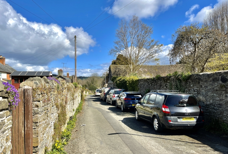
Location: Boundary wall to rear ground at St David's and the Manor House, St David's Street.
County: Powys
Community: Presteigne (Llanandras)
Community: Presteigne
Built-Up Area: Presteigne
Traditional County: Radnorshire
Tagged with: Wall
8 to 10 feet high stone rubble wall, partly ivy clad, running from the brick jamb of the garage beside No 2 Pound Lane and ending with a vertical joint against the Coach House. The wall has one further vertical joint and one small boarded door with brick jambs and a wooden lintel.
Included for group value.
External links are from the relevant listing authority and, where applicable, Wikidata. Wikidata IDs may be related buildings as well as this specific building. If you want to add or update a link, you will need to do so by editing the Wikidata entry.


Other nearby listed buildings
