Approximate Location Map
Large Map »
Latitude: 51.8245 / 51°49'28"N
Longitude: -3.0233 / 3°1'23"W
OS Eastings: 329569
OS Northings: 214482
OS Grid: SO295144
Mapcode National: GBR F5.W8P3
Mapcode Global: VH796.KD1P
Plus Code: 9C3RRXFG+RM
Entry Name: House, including attached railings
Listing Date: 6 September 1973
Last Amended: 10 November 2005
Grade: II
Source: Cadw
Source ID: 86854
ID on this website: 300086854
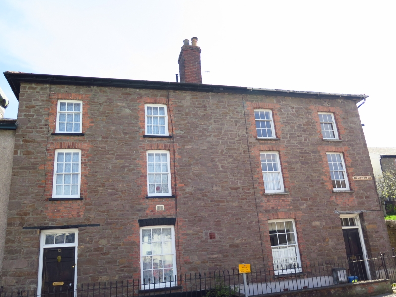
Location: At W end of the terraced row running S from the junction with Brecon Road.
County: Monmouthshire
Town: Abergavenny
Community: Abergavenny (Y Fenni)
Community: Abergavenny
Built-Up Area: Abergavenny
Traditional County: Monmouthshire
Tagged with: House
Early/mid C19 pair, probably c1830, with very little alteration. It is shown on the Tithe Map of 1844.
Rear elevation not inspected.
Interior not inspected at resurvey.
Included for its special interest as part of a well-preserved group of substantial early C19 terraced housing close to the junction with Brecon Road.
External links are from the relevant listing authority and, where applicable, Wikidata. Wikidata IDs may be related buildings as well as this specific building. If you want to add or update a link, you will need to do so by editing the Wikidata entry.


Other nearby listed buildings
