Latitude: 50.8324 / 50°49'56"N
Longitude: -2.5242 / 2°31'27"W
OS Eastings: 363180
OS Northings: 103779
OS Grid: ST631037
Mapcode National: GBR MT.WY0L
Mapcode Global: FRA 56LW.Y5M
Plus Code: 9C2VRFJG+W8
Entry Name: The Cross and Hand
Listing Date: 11 July 1951
Grade: II
Source: Historic England
Source ID: 1118653
English Heritage Legacy ID: 105331
ID on this website: 101118653
Location: Dorset, DT2
County: Dorset
Civil Parish: Batcombe
Traditional County: Dorset
Lieutenancy Area (Ceremonial County): Dorset
Church of England Parish: Batcombe St Mary
Church of England Diocese: Salisbury
ST 60 SW at NGR 632038 BATCOMBE BATCOMBE DOWN
4/6 The Cross and Hand 11.7.51 GV II
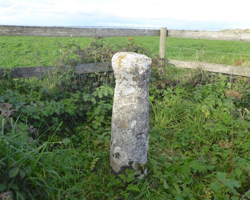
Wayside monolithic shaft, with necking and capital. Medieval. Stone monolith of oval form, crudely tapering. Dimensions: Height c 107cm, capital 28cm square. "It is possible that this shaft belongs to the group of pre-conquest shafts of which the pillar of Eliseg is the best known; if so the capital must have been cut down. The hand said to have been carved on one face is not traceable." (RCHM) Scheduled Ancient Monument Dorset No. 137. (RCHM Dorset I, p17 (2))
Listing NGR: ST6318003779


Other nearby listed buildings