Approximate Location Map
Large Map »
Latitude: 52.0334 / 52°2'0"N
Longitude: 0.5013 / 0°30'4"E
OS Eastings: 571678
OS Northings: 240173
OS Grid: TL716401
Mapcode National: GBR PFX.FL2
Mapcode Global: VHJHQ.M5W1
Plus Code: 9F422GM2+9G
Entry Name: Three Chimneys Farmhouse
Listing Date: 16 May 1984
Grade: II
Source: Historic England
Source ID: 1122315
English Heritage Legacy ID: 114116
ID on this website: 101122315
Location: Wesley End, Braintree, Essex, CO9
County: Essex
District: Braintree
Civil Parish: Ridgewell
Traditional County: Essex
Lieutenancy Area (Ceremonial County): Essex
Church of England Parish: Ridgewell St Laurence
Church of England Diocese: Chelmsford
Tagged with: Farmhouse
TL 74 SW RIDGEWELL
3/42 Three Chimneys Farmhouse
II
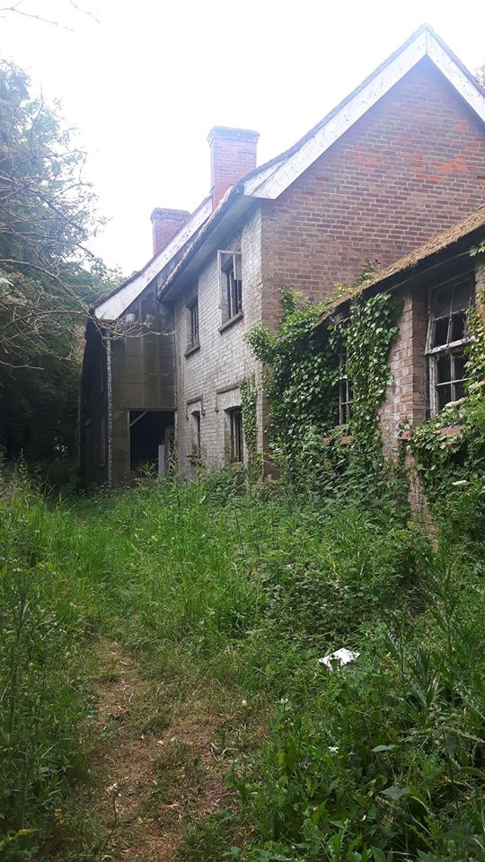
House, C16 and C17, extended in C19. Timber framed, mainly plastered with some
brick cladding, partly roofed with handmade red clay tiles. S crosswing of 2
bays, C16, and 3-bay range to N, C17. One axial chimney stack at the junction
and 2 other axial stacks. N extension of red brick, late C19. Aspect E. Door
of 6 fielded panels, rectangular light over with radiating tracery, 2 tripartite
double-hung sash windows of 4-16-4 lights, one double-hung sash window of 16
lights, all early C19. On first floor, 4 double-hung sash windows of 16 lights,
early C19. Some crown glass. In N extension, 2 casement windows on each floor,
with brick labels over ground floor windows, C19. The S crosswing has jowled
posts, curved braces trenched to the outside of heavy studding, binding beam
originally moulded but later squared off, all joists of horizontal section with
bowtell mouldings. Clasped purlin roof hipped to rear only. Main range has
primary straight bracing, 2 plain-chamfered transverse beams (one with lamb's
tongue stops), joists of vertical section. At the time of the survey, October
1983, the main range has been newly roofed, but the S chimney stack is partly
demolished and the S crosswing is without roof cladding. This building is at
the junction of 3 parishes, Stambourne, Ridgewell and Birdbrook. In the RCHM
survey and the 1952 schedule it is included in Stambourne, but it is more
appropriately included in Ridgewell, as the access is from this parish.
Listing NGR: TL7167840173
External links are from the relevant listing authority and, where applicable, Wikidata. Wikidata IDs may be related buildings as well as this specific building. If you want to add or update a link, you will need to do so by editing the Wikidata entry.


Other nearby listed buildings
