Latitude: 51.6925 / 51°41'32"N
Longitude: -1.6927 / 1°41'33"W
OS Eastings: 421338
OS Northings: 199346
OS Grid: SU213993
Mapcode National: GBR 4ST.YP1
Mapcode Global: VHC0B.MQ0F
Plus Code: 9C3WM8R4+XW
Entry Name: Lechlade Halfpenny Bridge Tollhouse
Listing Date: 26 November 1958
Grade: II
Source: Historic England
Source ID: 1303058
English Heritage Legacy ID: 129072
ID on this website: 101303058
Location: Lechlade-on-Thames, Cotswold, Gloucestershire, GL7
County: Gloucestershire
District: Cotswold
Civil Parish: Lechlade
Built-Up Area: Lechlade-on-Thames
Traditional County: Berkshire
Lieutenancy Area (Ceremonial County): Gloucestershire
Church of England Parish: Lechlade St Lawrence
Church of England Diocese: Gloucester
Tagged with: Tollhouse
LECHLADE THAMES STREET SU 2199 10/230 Lechlade Halfpenny Bridge and Tollhouse (that part in 26.11.52 Cotswold District)
II
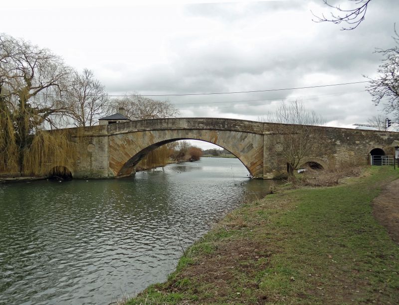
Roadbridge carrying Thames Street (A361) over River Thames and toll house. 1792, when Thames Street laid out. Dressed stone. Bridge about 6m wide with coped wall about lm high following considerable arch of bridge and splaying out at each corner. Roadway from toll house to centre district boundary line about 10m. Single large semi-circular arch approximately 8m high at apex, with straight large roll moulded string course over. Side piers each have blind round oculus and very small semi-circular arches at base. Toll house on north east corner, small square of 2 storeys with basement and road-level room in coursed stone with asbestos slate pyramidal roof and brick stack to east. Large roll moulded string course between floors. Square window openings to south and north and door to west straight on to bridge. Said to be named after the halfpenny toll levied until 1839.
Listing NGR: SU2133199328
External links are from the relevant listing authority and, where applicable, Wikidata. Wikidata IDs may be related buildings as well as this specific building. If you want to add or update a link, you will need to do so by editing the Wikidata entry.


Other nearby listed buildings