Latitude: 51.7986 / 51°47'55"N
Longitude: -2.4226 / 2°25'21"W
OS Eastings: 370954
OS Northings: 211194
OS Grid: SO709111
Mapcode National: GBR FZ.XTZ8
Mapcode Global: VH875.Y1MZ
Plus Code: 9C3VQHXG+FX
Entry Name: Puckpool Farmhouse
Listing Date: 9 December 1986
Grade: II
Source: Historic England
Source ID: 1340708
English Heritage Legacy ID: 132281
ID on this website: 101340708
Location: Arlingham, Stroud, Gloucestershire, GL2
County: Gloucestershire
District: Stroud
Civil Parish: Arlingham
Built-Up Area: Arlingham
Traditional County: Gloucestershire
Lieutenancy Area (Ceremonial County): Gloucestershire
Church of England Parish: Arlingham St Mary the Virgin
Church of England Diocese: Gloucester
Tagged with: Farmhouse
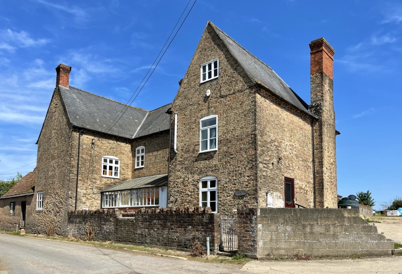
ARLINGHAM HIGH STREET SO 71 SW (east side) 2/23 Puckpool Farmhouse GV II Farmhouse. Late C18. Brick, slate roof hipped at both ends of front range, brick stacks with oversailing caps rebuilt in Cl9. U- shape with 2 shallow rear ranges, 2 storeys and attic. Four windows, 2-light wood mullion and transoms with segmental heads, brick dentils between single strings at eaves, and 2-brick string below. Ground floor windows partly altered, with half-glazed door in bay 2 with flat hood. Rear fenestration towards street mostly also 2-light wood mullion and transoms. Right hand return has 5- light attic wood mullion with iron glazing bars and wooden internal shutters, probably for ventilating cheese room.
Listing NGR: SO7095411194
External links are from the relevant listing authority and, where applicable, Wikidata. Wikidata IDs may be related buildings as well as this specific building. If you want to add or update a link, you will need to do so by editing the Wikidata entry.


Other nearby listed buildings