Latitude: 51.7862 / 51°47'10"N
Longitude: -2.1947 / 2°11'40"W
OS Eastings: 386665
OS Northings: 209741
OS Grid: SO866097
Mapcode National: GBR 1M0.XM5
Mapcode Global: VH94R.XC3K
Plus Code: 9C3VQRP4+F4
Entry Name: Baptist Chapel
Listing Date: 24 August 1990
Grade: II
Source: Historic England
Source ID: 1340518
English Heritage Legacy ID: 133368
ID on this website: 101340518
Location: Painswick, Stroud, Gloucestershire, GL6
County: Gloucestershire
District: Stroud
Civil Parish: Painswick
Built-Up Area: Painswick
Traditional County: Gloucestershire
Lieutenancy Area (Ceremonial County): Gloucestershire
Church of England Parish: Painswick St Mary the Virgin
Church of England Diocese: Gloucester
Tagged with: Chapel
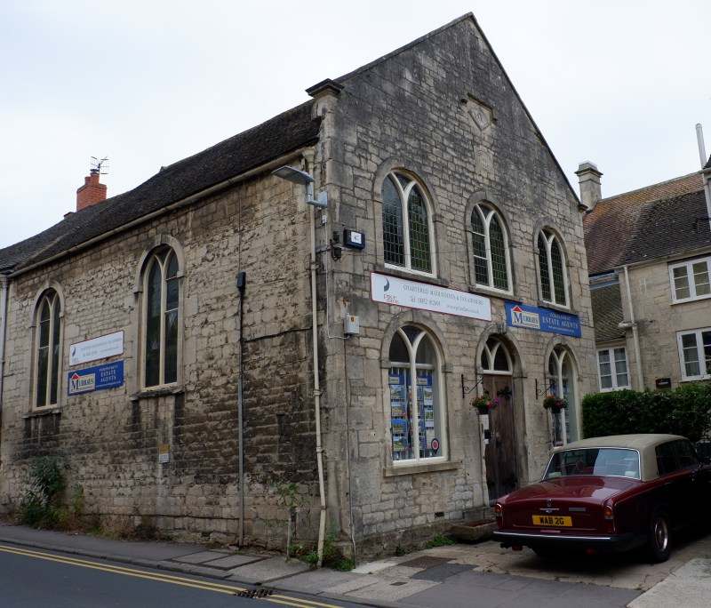
PAINSWICK NEW STREET SO 8609-8709 (Part) (south east side) 8/182 Baptist chapel GV II Former chapel, now commercial premises. Built 1806 or Wesleyans, sold to Baptists 1831. Coursed squared limestone, plain tile roof. Gable front facing down street is 3-windowed, 2 storeys with coped gable containing 1806 datestone in lozenge panel under, stopped drip mould, above a second oval panel with 'Baptist Chapel 183 '; 2-light round arched windows with Y-tracery and C20 lead- ing in plain architraves with keystone and impost blocks, pair of glazed doors under Y-tracery glazed head centrally. To New Street two 2-light windows as front. A handsome building, holding an important position in the street, as seen from the south. (Stell, C; Chapels and Meeting Houses, Central England; 1986).
Listing NGR: SO8666709742
External links are from the relevant listing authority and, where applicable, Wikidata. Wikidata IDs may be related buildings as well as this specific building. If you want to add or update a link, you will need to do so by editing the Wikidata entry.


Other nearby listed buildings