Approximate Location Map
Large Map »
Latitude: 50.8979 / 50°53'52"N
Longitude: -1.4052 / 1°24'18"W
OS Eastings: 441928
OS Northings: 111109
OS Grid: SU419111
Mapcode National: GBR RQM.41
Mapcode Global: FRA 76YQ.NDT
Plus Code: 9C2WVHXV+5W
Entry Name: The Weigh House
Listing Date: 14 July 1953
Grade: II*
Source: Historic England
Source ID: 1092049
English Heritage Legacy ID: 135819
Also known as: The Weigh House, French Street
ID on this website: 101092049
Location: Southampton, Hampshire, SO14
County: City of Southampton
Electoral Ward/Division: Bargate
Parish: Non Civil Parish
Built-Up Area: Southampton
Traditional County: Hampshire
Lieutenancy Area (Ceremonial County): Hampshire
Church of England Parish: Southampton City Centre St Mary
Church of England Diocese: Winchester
Tagged with: Building
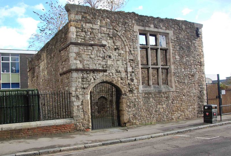
1. FRENCH STREET
5239 (east side)
The Weigh House
SU 4111 3/124 14.7.53
II*
2.
Mid C13 and C15. The shell of a mediaeval building which probably originally
housed the king's weigh beam. It is also mentioned in 1454 as the Paysage
House of the Earl of Warwick. One storey stone with C13 window in north wall
of 2 trefoiled lights with a quatrefoiled circle in the stonework between
their heads, and blocked C13 doorway in east wall. Four centred C15 doorway
to French Street. Scheduled as an ancient monument.
Listing NGR: SU4190811158
External links are from the relevant listing authority and, where applicable, Wikidata. Wikidata IDs may be related buildings as well as this specific building. If you want to add or update a link, you will need to do so by editing the Wikidata entry.


Other nearby listed buildings
