Approximate Location Map
Large Map »
Latitude: 50.8973 / 50°53'50"N
Longitude: -1.4059 / 1°24'21"W
OS Eastings: 441875
OS Northings: 111038
OS Grid: SU418110
Mapcode National: GBR RQH.FP
Mapcode Global: FRA 76YQ.N49
Plus Code: 9C2WVHWV+WJ
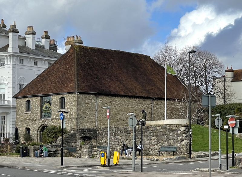
Entry Name: Remains of C15 House, Later Corn Store
Listing Date: 8 October 1981
Grade: II
Source: Historic England
Source ID: 1091976
English Heritage Legacy ID: 135939
ID on this website: 101091976
Location: Southampton, Hampshire, SO14
County: City of Southampton
Electoral Ward/Division: Bargate
Parish: Non Civil Parish
Built-Up Area: Southampton
Traditional County: Hampshire
Lieutenancy Area (Ceremonial County): Hampshire
Church of England Parish: Southampton City Centre St Mary
Church of England Diocese: Winchester
Tagged with: Building
1.
5239
SU 4111
3/243
TOWN QUAY
Remains of C15 house, later Corn Store
II
2.
C15 masonry wall varying between 2 and 8 feet in height. This incorporates
one pointed arched doorway now blocked with red brick.
Listing NGR: SU4187511038
External links are from the relevant listing authority and, where applicable, Wikidata. Wikidata IDs may be related buildings as well as this specific building. If you want to add or update a link, you will need to do so by editing the Wikidata entry.


Other nearby listed buildings
