Latitude: 52.2622 / 52°15'43"N
Longitude: -2.1182 / 2°7'5"W
OS Eastings: 392030
OS Northings: 262673
OS Grid: SO920626
Mapcode National: GBR 1FH.59M
Mapcode Global: VH92H.7DKN
Plus Code: 9C4V7V6J+VP
Entry Name: Coffin Bridge No 34
Listing Date: 26 August 1975
Grade: II
Source: Historic England
Source ID: 1081249
English Heritage Legacy ID: 147729
ID on this website: 101081249
Location: Hadzor, Wychavon, Worcestershire, WR9
County: Worcestershire
District: Wychavon
Civil Parish: Hadzor
Traditional County: Worcestershire
Lieutenancy Area (Ceremonial County): Worcestershire
Church of England Parish: Hadzor with Oddingley and Tibberton
Church of England Diocese: Worcester
HADZOR CP WORCESTER & BIRMINGHAM CANAL SO 96 SW SO 9246268 3/53 (14/81) Coffin Bridge No 34 26.8.75 - II
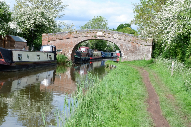
Canal accommodation bridge. Early C19. Red brick with blue brick parapet coping. Elliptical arch and cambered sides; parapet has a 2-course band at its base, is splayed at each end, and is terminated by square piers. The Worcester and Birmingham Canal was built for the Earl of Dudley between 1791 and 1815 to link the Birmingham Canal Navigations with the River Severn. Its primary purpose was as a means of supplying coal from the Black Country to the south-west Midlands. The towpath runs beneath the east side of the bridge.
Listing NGR: SO9203062673
External links are from the relevant listing authority and, where applicable, Wikidata. Wikidata IDs may be related buildings as well as this specific building. If you want to add or update a link, you will need to do so by editing the Wikidata entry.


Other nearby listed buildings