Approximate Location Map
Large Map »
Latitude: 52.3202 / 52°19'12"N
Longitude: -2.0912 / 2°5'28"W
OS Eastings: 393877
OS Northings: 269126
OS Grid: SO938691
Mapcode National: GBR 2G3.D3Z
Mapcode Global: VH923.PYT6
Plus Code: 9C4V8WC5+3G
Entry Name: The Tithe Barn and Adjacent Garden Walls About 10 Yards South-West of Grafton Manor and Adjoining Chapel
Listing Date: 17 July 1986
Grade: II
Source: Historic England
Source ID: 1100132
English Heritage Legacy ID: 156353
ID on this website: 101100132
Location: Bromsgrove, Worcestershire, B61
County: Worcestershire
District: Bromsgrove
Civil Parish: Dodford with Grafton
Traditional County: Worcestershire
Lieutenancy Area (Ceremonial County): Worcestershire
Tagged with: Wall Tithe barn
SO 96 NW DODFORD WITH GRAFTON CP GRAFTON LANE (north side)
11/88 The Tithe Barn and
adjoining garden walls
about 10 yards south-west
of Grafton Manor and
adjoining chapel
GV II
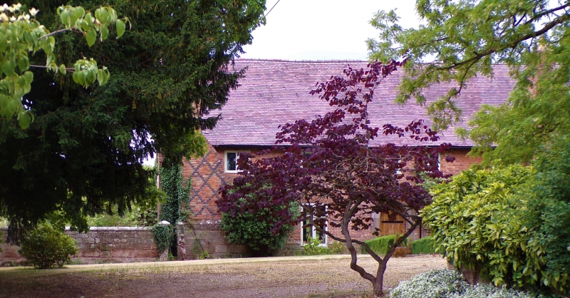
Barn, now house, and adjoining garden walls. Mid-C16 or earlier with mid-C19
alterations; restored and converted late C20. Part timber-framed with brick
refacing and replacement walling, part sandstone rubble and brick; plain tiled
roof with gable-end parapets, north parapet is crow-stepped, south parapet has
stone coping and cross finial. 5½ bays aligned north/south. Two levels.
East elevation: ground floor has two cross-casements and a 2-light window;
upper level has three 2-light casements and a single-light casement; entrance
in second bay from south end. South gable end rebuilt mid-C19 and has a
large pointed chamfered stone archway with double doors and a loophole in
the gable apex. A C16 stone-mullioned window and a rectangular light survive
in the west elevation. Interior: roof has intermediate arch-braced collar and
tie-beam trusses with struts and paired swept wind-braces. Two south bays have
stop-chamfered main ceiling beams and joists (now C20 replacements); cross-
frames survive; C20 additions to north-west end. Garden walls adjoin south
end; coursed dressed sandstone rubble with moulded coping; south-east wall runs
east for one yard, returns south for about 10 yards and then returns west for
about 3 yards; it varies between five and six feet high and has a square pier
with pyramidal capping at each corner and at its west end. The south-west wall
is of similar height, runs south for about 10 yards and has an east return of
about one yard long terminating in a square pier. The walls enclose a small
garden at the south end of the barn.
Listing NGR: SO9387769126
External links are from the relevant listing authority and, where applicable, Wikidata. Wikidata IDs may be related buildings as well as this specific building. If you want to add or update a link, you will need to do so by editing the Wikidata entry.


Other nearby listed buildings
