Approximate Location Map
Large Map »
Latitude: 51.2823 / 51°16'56"N
Longitude: 1.0837 / 1°5'1"E
OS Eastings: 615149
OS Northings: 158202
OS Grid: TR151582
Mapcode National: GBR TY2.JT0
Mapcode Global: VHLGM.Q1S9
Plus Code: 9F3373JM+WF
Entry Name: 78 and 79, Broad Street
Listing Date: 7 September 1973
Grade: II
Source: Historic England
Source ID: 1336805
English Heritage Legacy ID: 170432
ID on this website: 101336805
Location: Northgate, Canterbury, Kent, CT1
County: Kent
District: Canterbury
Electoral Ward/Division: Northgate
Parish: Non Civil Parish
Built-Up Area: Canterbury
Traditional County: Kent
Lieutenancy Area (Ceremonial County): Kent
Tagged with: Building
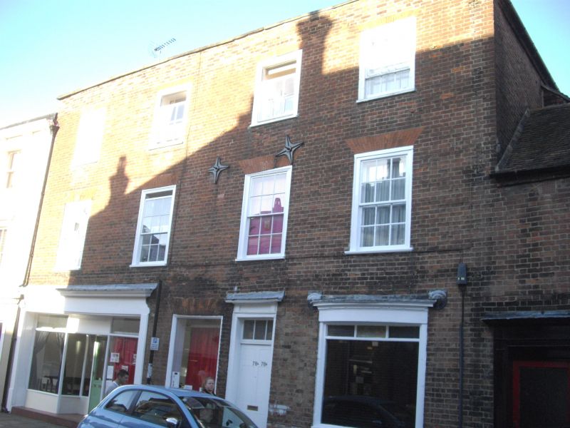
1.
944 BROAD STREET
(North East Side)
Nos 78 and 79
TR 1558 SW 3/439
II GV
2.
Early C19. 3 storeys red brick. Stone coping. 4 sashes in moulded wooden
architraves. Ground floor to No 78 has the remains of a bow and a simple
doorcase with rectangular fanlight and moulded architraves. No 79 has an
early C19 shopfront with 2 plain pilasters and cornice.
Nos 66 to 79 (consec) form a group.
Listing NGR: TR1514958202
External links are from the relevant listing authority and, where applicable, Wikidata. Wikidata IDs may be related buildings as well as this specific building. If you want to add or update a link, you will need to do so by editing the Wikidata entry.


Other nearby listed buildings
