Latitude: 51.2222 / 51°13'19"N
Longitude: 1.0492 / 1°2'57"E
OS Eastings: 613018
OS Northings: 151421
OS Grid: TR130514
Mapcode National: GBR TYT.82V
Mapcode Global: VHLGT.4JJX
Plus Code: 9F3362CX+VM
Entry Name: Court Lodge
Listing Date: 30 January 1967
Last Amended: 14 March 1980
Grade: II
Source: Historic England
Source ID: 1367128
English Heritage Legacy ID: 171369
ID on this website: 101367128
Location: Petham, Canterbury, Kent, CT4
County: Kent
District: Canterbury
Civil Parish: Petham
Traditional County: Kent
Lieutenancy Area (Ceremonial County): Kent
Tagged with: Gatehouse
1. 5273 PETHAM CHURCH LANE
Court Lodge (formerly listed as Court Lodge Farmhouse) TR 1351 37/517 30.1.67
II GV
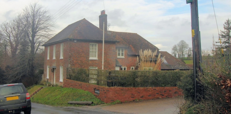
2. Timber-framed building refronted in brick in C18. Front range 2 storeys red brick with grey headers. Hipped tiled roof. Three sashes with glazing bars intact. Simple doorcase. The rear part is timber-framed refaced in red brick with half-hipped tiled roof.
Listing NGR: TR1303851420
External links are from the relevant listing authority and, where applicable, Wikidata. Wikidata IDs may be related buildings as well as this specific building. If you want to add or update a link, you will need to do so by editing the Wikidata entry.


Other nearby listed buildings