Approximate Location Map
Large Map »
Latitude: 51.3056 / 51°18'20"N
Longitude: 1.1426 / 1°8'33"E
OS Eastings: 619141
OS Northings: 160967
OS Grid: TR191609
Mapcode National: GBR TXZ.1P9
Mapcode Global: VHLGG.RFDZ
Plus Code: 9F33844V+62
Entry Name: Ashby Cottage
Listing Date: 2 May 1978
Grade: II
Source: Historic England
Source ID: 1085487
English Heritage Legacy ID: 171537
ID on this website: 101085487
Location: Westbere, Canterbury, Kent, CT2
County: Kent
District: Canterbury
Civil Parish: Westbere
Built-Up Area: Sturry
Traditional County: Kent
Lieutenancy Area (Ceremonial County): Kent
Tagged with: Cottage Thatched cottage
1.
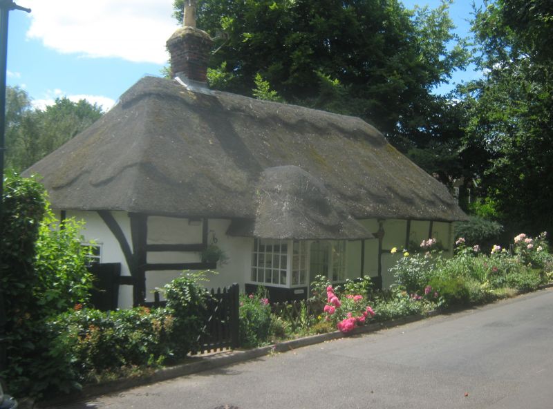
5273 WESTBERE WESTBERE LANE
(south side)
Ashby Cottage
TR 16 SE 4/664 2.5.78
II GV
2.
Probably C17 timber-framed cottage. One storey. Bottom part of ground floor
painted brick above post and pan timber-framing with plaster infill. Half-hipped
thatched roof. C19 doorcase with plain spandrels.
Listing NGR: TR1927761008
External links are from the relevant listing authority and, where applicable, Wikidata. Wikidata IDs may be related buildings as well as this specific building. If you want to add or update a link, you will need to do so by editing the Wikidata entry.


Other nearby listed buildings
