Approximate Location Map
Large Map »
Latitude: 51.3353 / 51°20'6"N
Longitude: 1.418 / 1°25'4"E
OS Eastings: 638178
OS Northings: 165121
OS Grid: TR381651
Mapcode National: GBR X0L.C8Y
Mapcode Global: VHMCW.JPHR
Plus Code: 9F338CP9+45
Entry Name: 12, Broad Street
Listing Date: 4 February 1988
Grade: II
Source: Historic England
Source ID: 1100299
English Heritage Legacy ID: 171701
ID on this website: 101100299
Location: Ramsgate, Thanet, Kent, CT11
County: Kent
District: Thanet
Civil Parish: Ramsgate
Built-Up Area: Ramsgate
Traditional County: Kent
Lieutenancy Area (Ceremonial County): Kent
Tagged with: Building
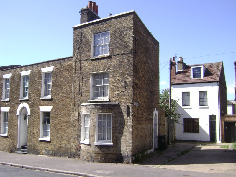
RAMSGATE BROAD STREET
TR 3865 SW
(west side)
9/72 No. 12
GV II
House. Circa 1830. Stock brick and slate roof. Three storeys and
parapet with stack to left. Glazing bar sash on 2nd floor and 1st floor
and bow on ground floor with 2 glazing bar sashes, all with gauged heads.
Door of 6 panels in right return with rusticated surround, and C20 iron
outer gate.
Listing NGR: TR3817765120
External links are from the relevant listing authority and, where applicable, Wikidata. Wikidata IDs may be related buildings as well as this specific building. If you want to add or update a link, you will need to do so by editing the Wikidata entry.


Other nearby listed buildings
