Approximate Location Map
Large Map »
Latitude: 51.2866 / 51°17'11"N
Longitude: 0.1811 / 0°10'51"E
OS Eastings: 552193
OS Northings: 156418
OS Grid: TQ521564
Mapcode National: GBR T4.NBY
Mapcode Global: VHHPL.3X2L
Plus Code: 9F3275PJ+JC
Entry Name: Farm Buildings Adjoining Bradbourne Farmhouse
Listing Date: 29 September 1972
Grade: II
Source: Historic England
Source ID: 1281426
English Heritage Legacy ID: 172159
ID on this website: 101281426
Location: St John's, Sevenoaks, Kent, TN13
County: Kent
District: Sevenoaks
Civil Parish: Sevenoaks
Built-Up Area: Sevenoaks
Traditional County: Kent
Lieutenancy Area (Ceremonial County): Kent
Church of England Parish: Riverhead St Mary
Church of England Diocese: Rochester
Tagged with: Farmhouse
BRADBOURNE VALE ROAD
1.
1614
(North Side)
Farm Buildings adjoining
Bradbourne Farmhouse
TQ 55 NW/3/101A
II
2.
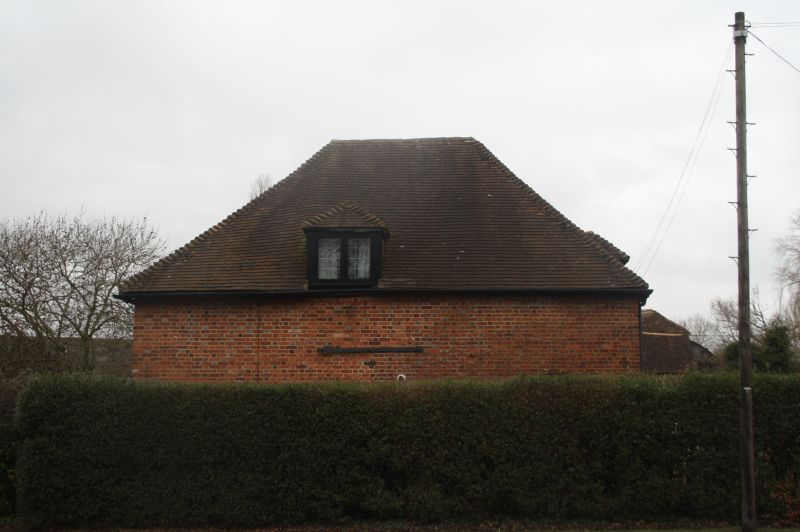
Group of farm buildings, including C18 barn of coursed local stone with
half hipped ridge tile roof.
Listing NGR: TQ5223756380
External links are from the relevant listing authority and, where applicable, Wikidata. Wikidata IDs may be related buildings as well as this specific building. If you want to add or update a link, you will need to do so by editing the Wikidata entry.


Other nearby listed buildings
