Approximate Location Map
Large Map »
Latitude: 51.2258 / 51°13'33"N
Longitude: 1.4029 / 1°24'10"E
OS Eastings: 637691
OS Northings: 152909
OS Grid: TR376529
Mapcode National: GBR X1Y.1HT
Mapcode Global: VHMDG.8GH3
Plus Code: 9F336CG3+85
Entry Name: 1, Oak Street
Listing Date: 20 August 1973
Grade: II
Source: Historic England
Source ID: 1069783
English Heritage Legacy ID: 177236
ID on this website: 101069783
Location: Deal, Dover, Kent, CT14
County: Kent
District: Dover
Civil Parish: Deal
Built-Up Area: Deal
Traditional County: Kent
Lieutenancy Area (Ceremonial County): Kent
Tagged with: Building
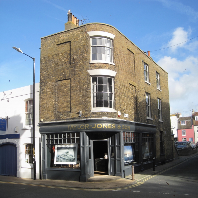
OAK STREET
1.
1035
(North Side)
No 1
TR 5752 NE 1/381 20.8.73.
II GV
2.
Early C19. 3 storeys and basement yellow brick. Stone coping. 2 sashes and
1 blank to Oak Street elevations. Later shop front. Simple doorcase with segmental
fanlight. Rounndel corner with 1 blank into High Street.
No 1 and No 114 High Street form a group.
Listing NGR: TR3769152909
External links are from the relevant listing authority and, where applicable, Wikidata. Wikidata IDs may be related buildings as well as this specific building. If you want to add or update a link, you will need to do so by editing the Wikidata entry.


Other nearby listed buildings
