Approximate Location Map
Large Map »
Latitude: 51.0668 / 51°4'0"N
Longitude: 0.6844 / 0°41'3"E
OS Eastings: 588181
OS Northings: 133150
OS Grid: TQ881331
Mapcode National: GBR QW8.5TG
Mapcode Global: FRA D6B9.DGP
Plus Code: 9F323M8M+PQ
Entry Name: 109, High Street
Listing Date: 8 June 1972
Grade: II
Source: Historic England
Source ID: 1363196
English Heritage Legacy ID: 179735
ID on this website: 101363196
Location: Tenterden, Ashford, Kent, TN30
County: Kent
District: Ashford
Civil Parish: Tenterden
Built-Up Area: Tenterden
Traditional County: Kent
Lieutenancy Area (Ceremonial County): Kent
Tagged with: Building
1.
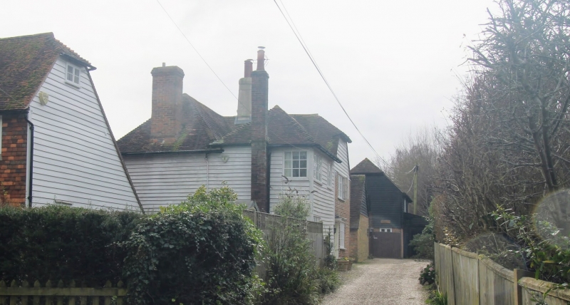
1715 HIGH STREET
(South Side)
No 109
TQ 8833 1/183
II GV
2.
C18 to C19. 2 storeys. The right side is red brick with grey headers,
the left side is weatherboarded. Tiled roof. Doorcase set in simple
moulden wooden surround with flat hood.
Nos 79 to 117 (odd) form a group.
Listing NGR: TQ8818333148
External links are from the relevant listing authority and, where applicable, Wikidata. Wikidata IDs may be related buildings as well as this specific building. If you want to add or update a link, you will need to do so by editing the Wikidata entry.


Other nearby listed buildings
