Approximate Location Map
Large Map »
Latitude: 51.0568 / 51°3'24"N
Longitude: 0.6372 / 0°38'13"E
OS Eastings: 584910
OS Northings: 131912
OS Grid: TQ849319
Mapcode National: GBR QW6.RWY
Mapcode Global: FRA D67B.62J
Plus Code: 9F323J4P+PV
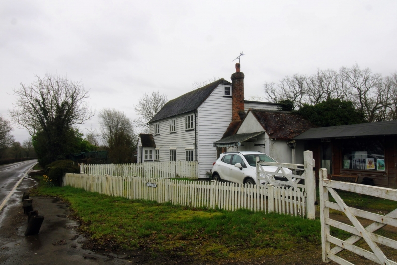
Entry Name: Stillwaters
Listing Date: 9 August 1979
Grade: II
Source: Historic England
Source ID: 1070903
English Heritage Legacy ID: 180400
ID on this website: 101070903
Location: Rolvenden, Ashford, Kent, TN17
County: Kent
District: Ashford
Civil Parish: Rolvenden
Traditional County: Kent
Lieutenancy Area (Ceremonial County): Kent
Tagged with: Building
ROLVENDEN TENTERDEN ROAD
1.
5272
Stillwaters
TQ 8431 18/348
II
2.
C18. Two storeys faced with weatherboarding. Tiled roof with pentice behind.
Three casement windows. Doorcases with pediment shaped hoods over.
Listing NGR: TQ8491031912
External links are from the relevant listing authority and, where applicable, Wikidata. Wikidata IDs may be related buildings as well as this specific building. If you want to add or update a link, you will need to do so by editing the Wikidata entry.


Other nearby listed buildings
