Approximate Location Map
Large Map »
Latitude: 51.2095 / 51°12'34"N
Longitude: 0.7936 / 0°47'36"E
OS Eastings: 595223
OS Northings: 149297
OS Grid: TQ952492
Mapcode National: GBR RW0.3FR
Mapcode Global: VHKK6.PVWN
Plus Code: 9F326Q5V+RC
Entry Name: 1 and 3, High Street
Listing Date: 10 October 1980
Grade: II
Source: Historic England
Source ID: 1299564
English Heritage Legacy ID: 180722
ID on this website: 101299564
Location: Charing, Ashford, Kent, TN27
County: Kent
District: Ashford
Civil Parish: Charing
Built-Up Area: Charing
Traditional County: Kent
Lieutenancy Area (Ceremonial County): Kent
Tagged with: Building
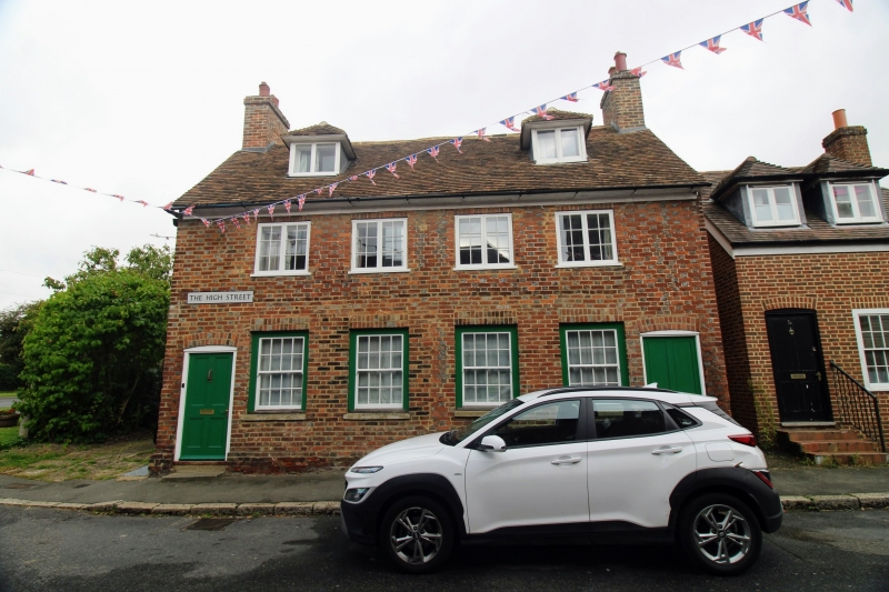
1. CHARING HIGH STREET
5272 (west side)
Nos 1 and 3
TQ 9549 22/45
II GV
2.
C18. Two storeys and attics red brick and grey headers. Tiled roof with 2
hipped dormers. Moulded wooden eaves cornice. Four casement windows above
ground floor. Modern shop windows below.
Listing NGR: TQ9522049297
External links are from the relevant listing authority and, where applicable, Wikidata. Wikidata IDs may be related buildings as well as this specific building. If you want to add or update a link, you will need to do so by editing the Wikidata entry.


Other nearby listed buildings
