Latitude: 51.1705 / 51°10'13"N
Longitude: 0.8172 / 0°49'1"E
OS Eastings: 597041
OS Northings: 145025
OS Grid: TQ970450
Mapcode National: GBR RWF.HG2
Mapcode Global: VHKKF.3VW1
Plus Code: 9F325RC8+6V
Entry Name: Kings Head
Listing Date: 10 October 1980
Grade: II
Source: Historic England
Source ID: 1362664
English Heritage Legacy ID: 180991
ID on this website: 101362664
Location: Hothfield, Ashford, Kent, TN26
County: Kent
District: Ashford
Civil Parish: Hothfield
Traditional County: Kent
Lieutenancy Area (Ceremonial County): Kent
Tagged with: Inn
This list entry was subject to a Minor Amendment on 28 July 2025 to update the Name and Address and reformat the text to current standards
TQ 94 NE
11/70
HOTHFIELD
THE STREET
Kings Head
(Formerly listed as No 24 (The Thanet Arms Inn))
II
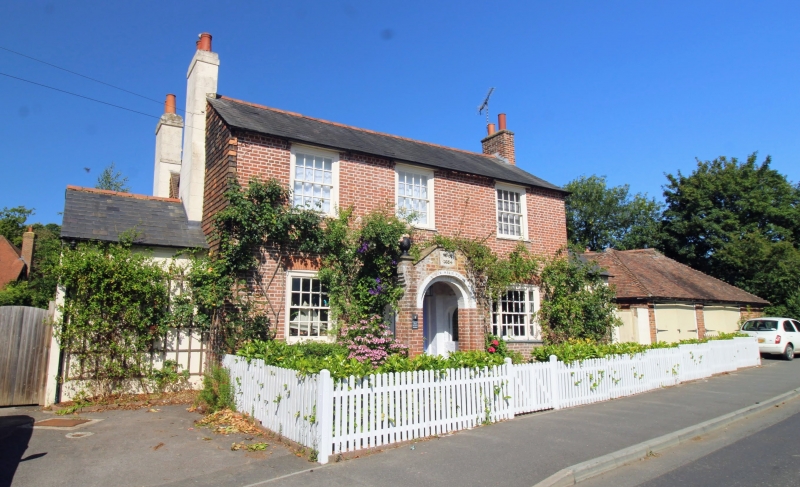
Originally called the King's Head Inn. The rear portion to the west is C17 or earlier timber-framed, refaced with red brick on the south and with a tiled pentice to the north. The east wing consists of two parallel ranges, running north and south, which were added in 1834. Two storeys red brick, the south wall tile-hung. the east range has a slate roof, the west range a tiled roof. Three sashes with glazing bars intact. The ground floor windows are triple sashes with cambered heads. Gabled porch with a stone in it inscribed "WR 1834".
Listing NGR: TQ9704145024
External links are from the relevant listing authority and, where applicable, Wikidata. Wikidata IDs may be related buildings as well as this specific building. If you want to add or update a link, you will need to do so by editing the Wikidata entry.


Other nearby listed buildings